|
Peru, the third largest country in South America.The capital and largest city is Lima. We have visited Lima, Arequipa, Colca Canyon, Puno, Lake Titicaca, Cuzco, Chinchero -Sacred Valley, Inca fortress at Ollantaytambo, Vistadome train to Machu Picchu. We have visited in the year 2025.
The local fruits and vegetables market in Lima
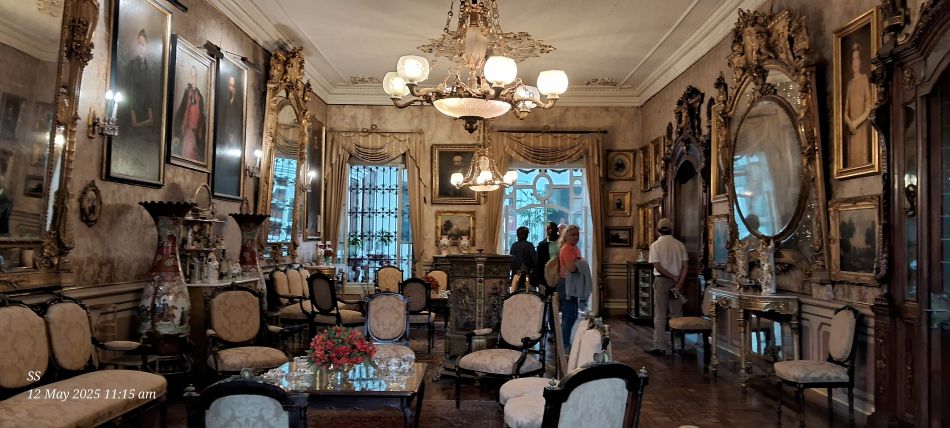
Casa de Aliaga (or Aliaga House) a historic colonial mansion. The specific room is the Salon Dorado (Golden Room).
This mansion is having been owned and occupied by the Aliaga family for 18 generations.
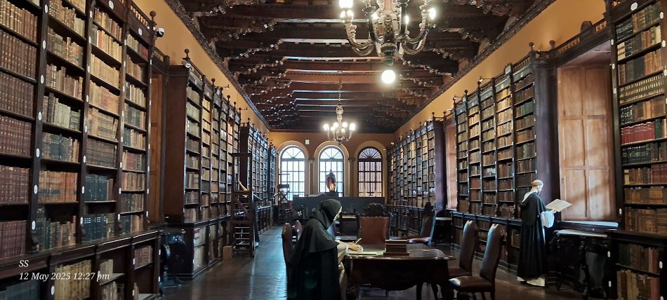
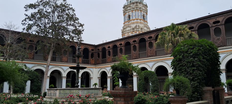
The historic library within the Basilica and Convent of Santo Domingo in Lima
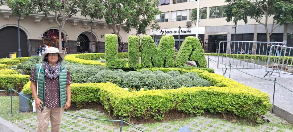
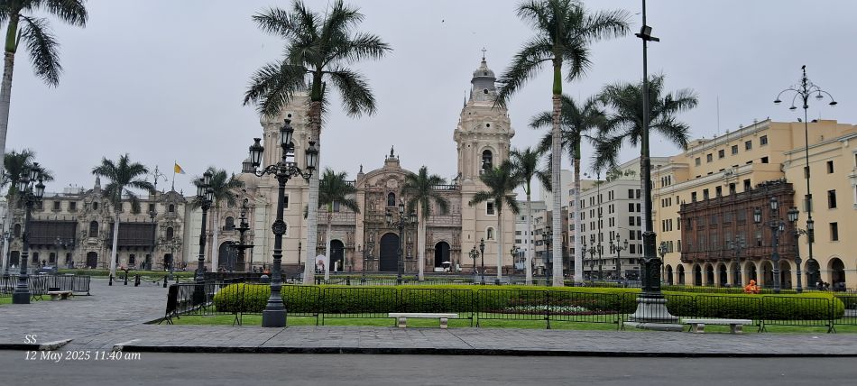
This iconic landmark is located in a city square, Lima
The Cathedral of Lima, This historic landmark is the oldest and largest church,Located in the Plaza Mayor (also known as the Plaza de Armas) in the historic center of Lima,
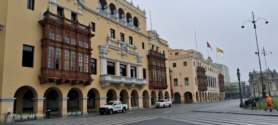
The Palacio Municipal de Lima (Municipal Palace or City Hall). This prominent yellow building is a prime example of neocolonial architecture, characterized by its large, ornate wooden balconies
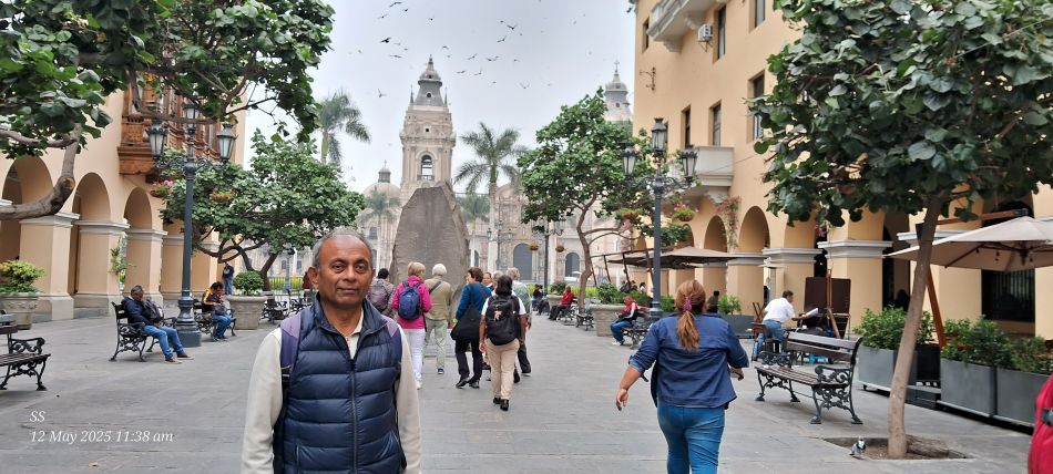
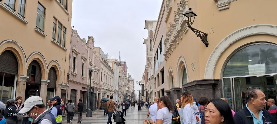
The Pasaje Santa Rosa, a pedestrian street that connects the Plaza Mayor with other parts of the historic center.
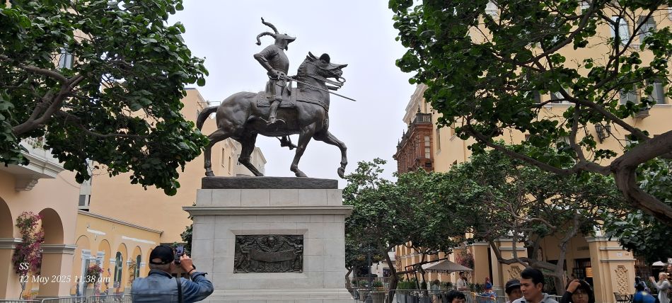
The equestrian statue of Francisco Pizarro, a Spanish conquistador best known for leading the expeditions that led to the conquest of the Inca Empire and the founding of the city of Lima.
A prominent pedestrianized street located in the Historic Center of Lima.
The serene central courtyard of the Basilica and Convent of Santo Domingo
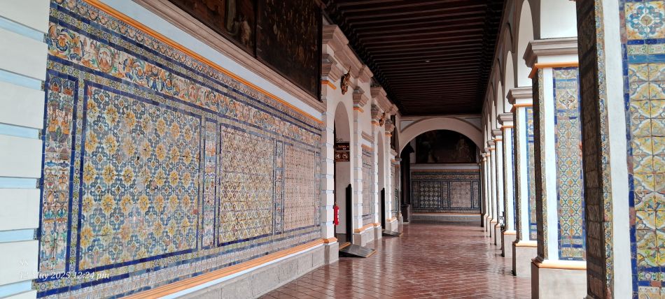
The ornate interior cloisters of the Convent of Santo Domingo. The walls are decorated with intricate, colorful 17th-century tiles imported from Seville, Spain
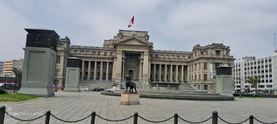
The Palace of Justice, it serves as the main seat of the Supreme Court of Peru.
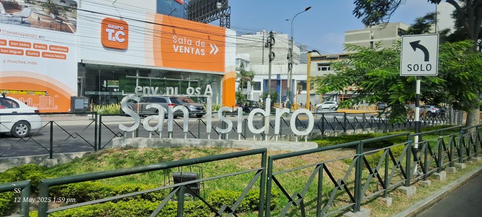
The San Isidro district is the financial heart of Lima
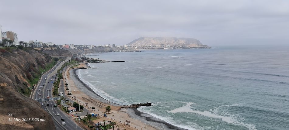
The Costa Verde (Green Coast) coastline is the 20+ kilometer coastal road and beach circuit that connects several of Lima's districts, including Chorrillos, Barranco, and Miraflores.
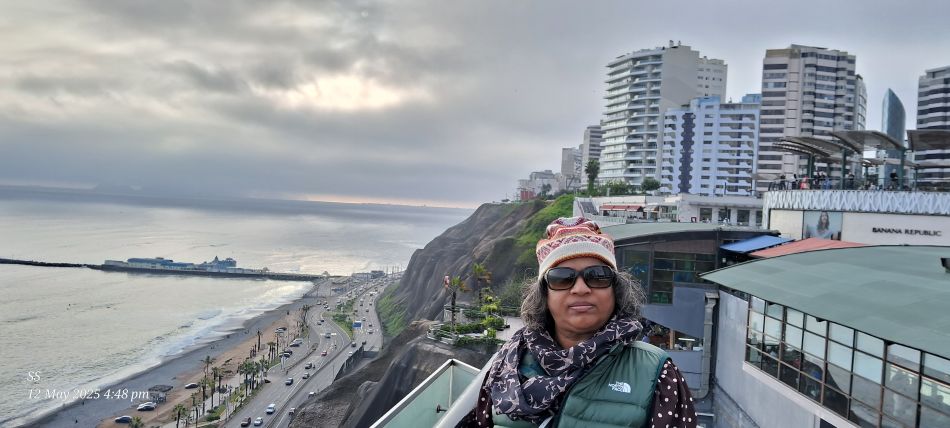
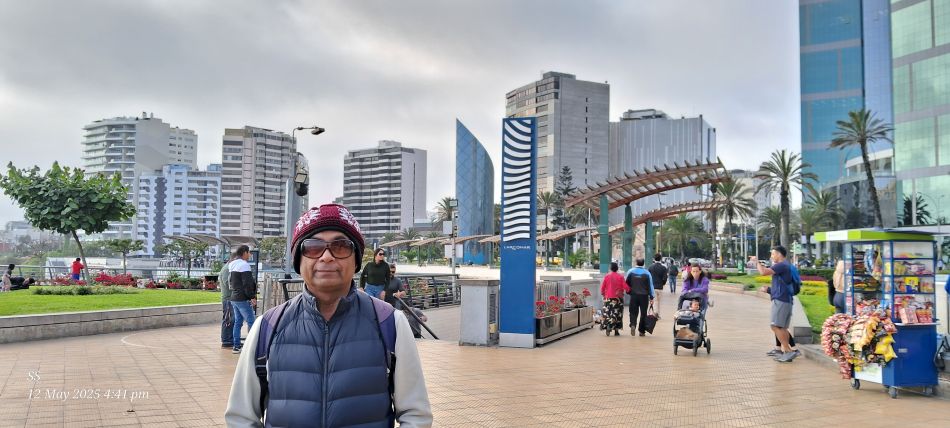
At the Larcomar shopping center in the Miraflores district of Lima. This unique open-air mall is built directly into the cliffs of the Costa Verde, offering panoramic views of the Pacific Ocean.
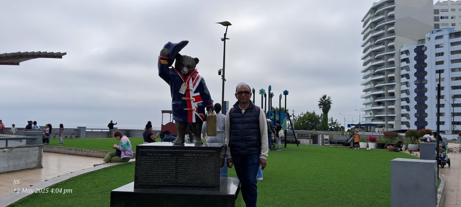
The Paddington Bear Statue located in Parque Salazar.The statue serves as a symbol of friendship between the UK and Peru, as Paddington's character in Michael Bond's children's books originally comes from "darkest Peru".
For a photo stop at the Larcomar shopping center and the adjacent Salazar Park
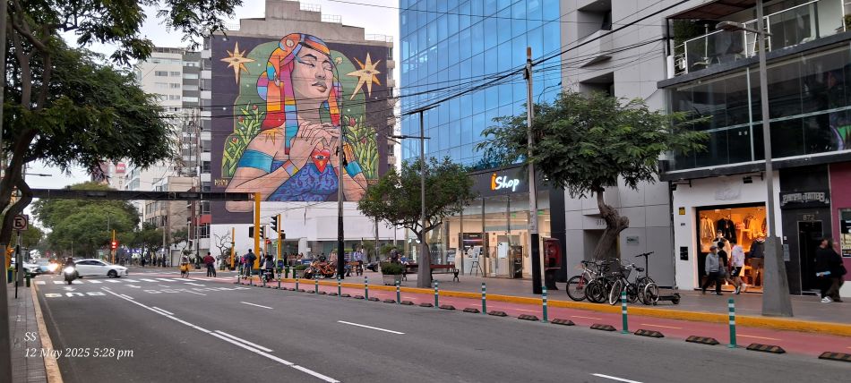
This mural, titled "Sentir con el corazon" (Feeling with the heart), is located in the Miraflores district of Lima. Painted by the renowned Peruvian street artist Edwin Higuchi Fernandez. The artwork was part of the Lima Mural Project
The Palacio Municipal de Miraflores (Miraflores City Hall)
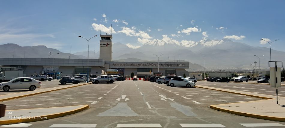
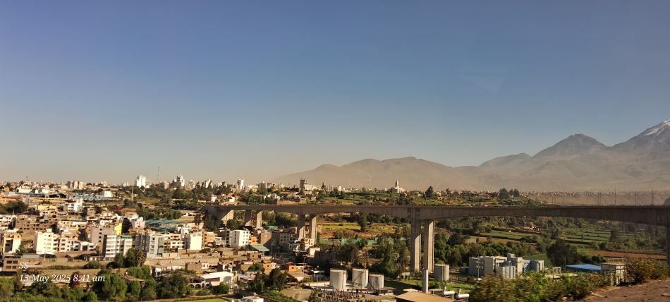
The Alfredo Rodriguez Ballon International Airport in Arequipa, Peru.
The Basilica Cathedral of Arequipa, The cathedral is a defining landmark of the city's Historic Centre, which was designated a UNESCO World Heritage Site in 2000
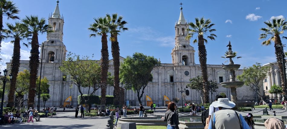
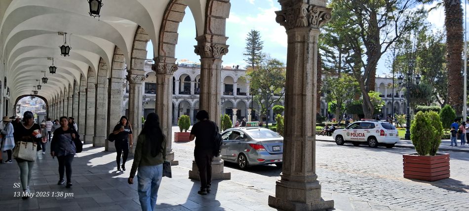
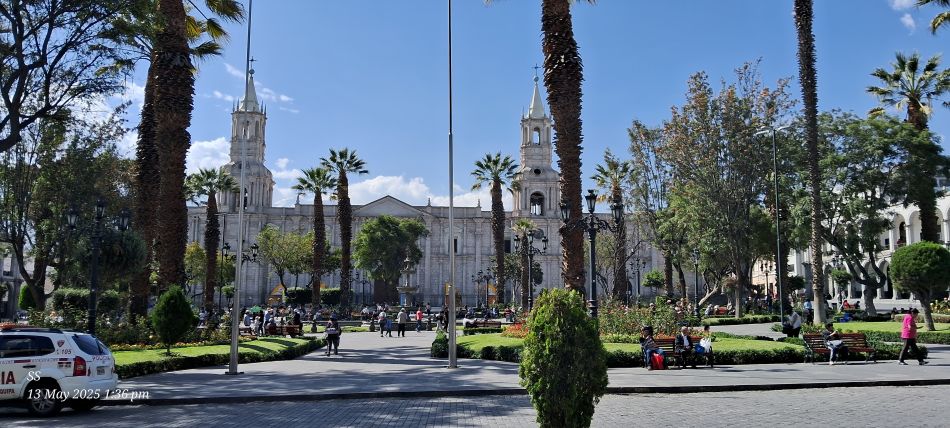
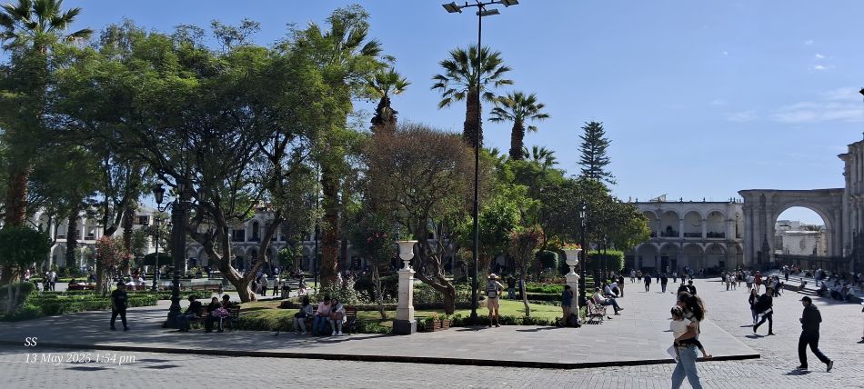
The Plaza de Armas in Arequipa,The iconic colonial-era arcades known as the Portales de Arequipa.
The Plaza de Armas, This central square is a key landmark in Arequipa's historical center.
the Plaza de Armas of Arequipa, The plaza is celebrated for its colonial architecture, characterized by buildings constructed from white volcanic stone called sillar.which gives the city its famous nickname as "white city".
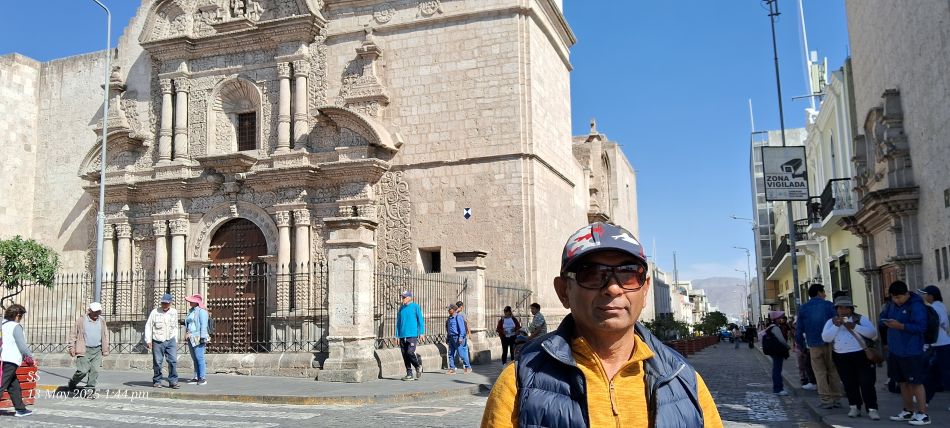
The outside stunning facade of the Church of the Company. The church is considered a masterpiece of Andean Baroque art, characterized by an incredibly ornate facade that integrates European and indigenous building techniques.
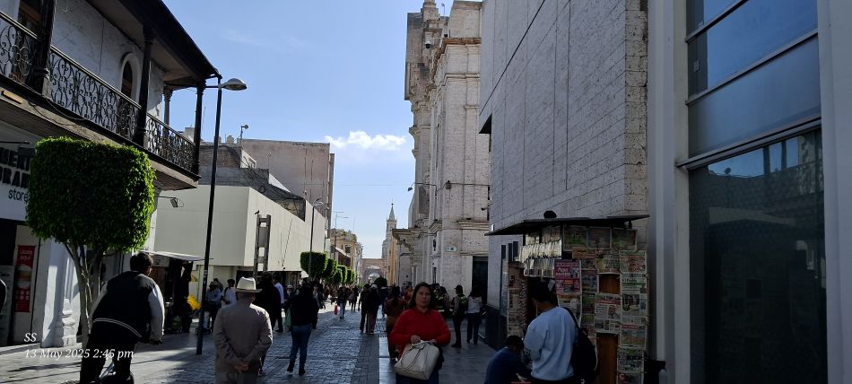
A pedestrian street in the Historic Centre of Arequipa. This area is famously known as the "White City" because many of its colonial buildings are constructed from sillar, a white volcanic stone.
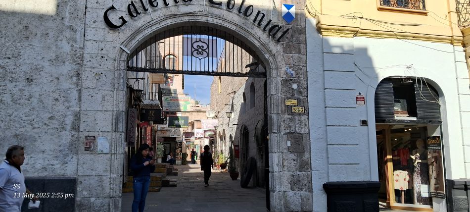
The entrance to Galería Colonial, a historic shopping arcade in the heart of Arequipa.
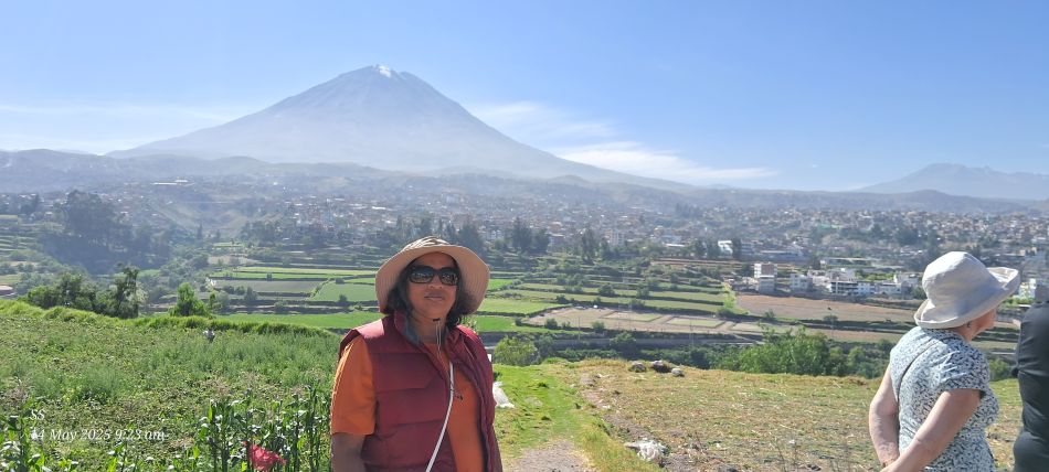
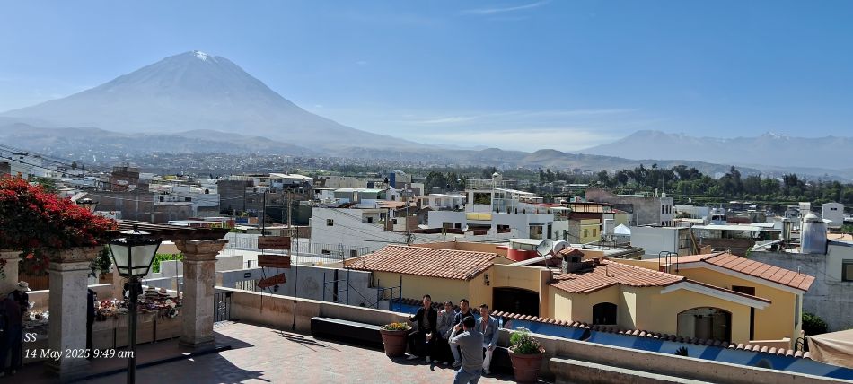
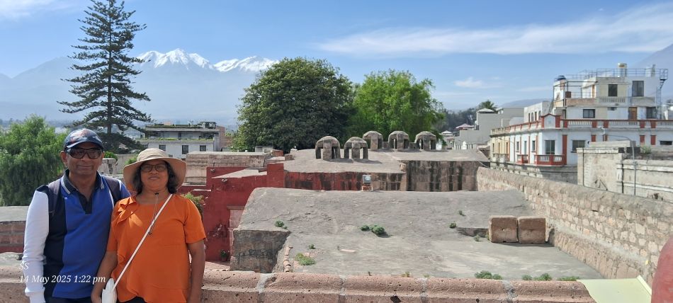
The iconic Misti volcano also known as El Misti, which towers over the city of Arequipa.
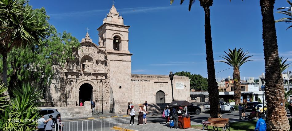
The Parroquia San Juan Bautista de Yanahuara, a historic colonial church located in the Yanahuara District of Arequipa
Views of the city and its surrounding volcanoes.
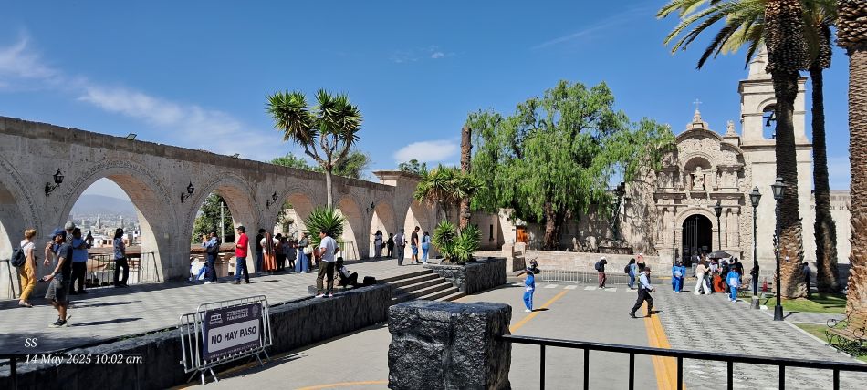
the Plaza de Yanahuara in the Yanahuara District of Arequipa, Two of the city's most significant historical landmarks a series of sillar stone arches and a colonial-era church.
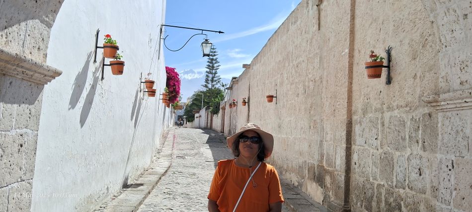
The picturesque alleyway in the Yanahuara district of Arequipa, The walls are built from sillar, a white volcanic stone that gives Arequipa its nickname, the White City.
One more view of The Church of the Company
Cloisters meaning open space surrounded by covered walks or open galleries in religious houses. Cloisters of the Company, Constructed in the 18th century, these cloisters are part of the larger Jesuit Church of the Company complex.
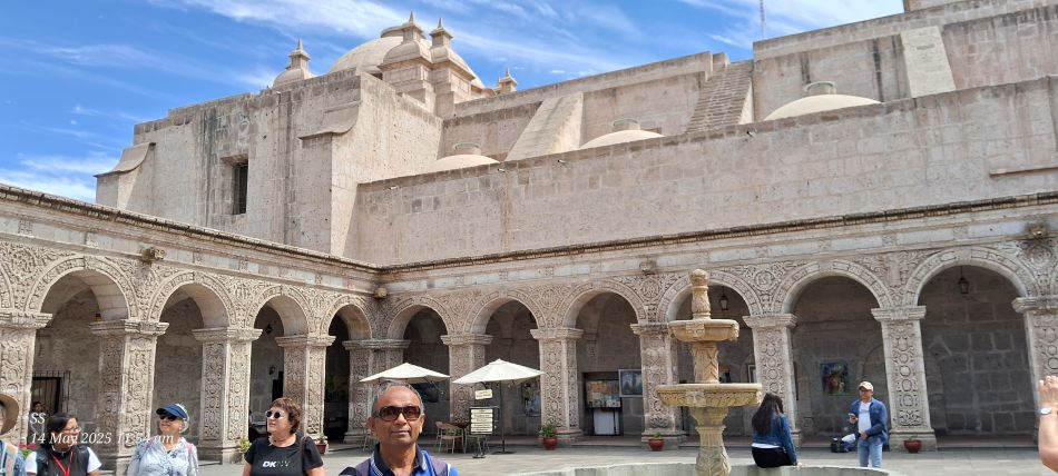
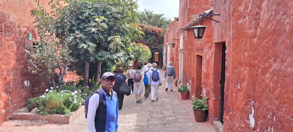
The Santa Catalina Monastery in Arequipa Known as a city within a city, this expansive colonial complex is famous for its narrow cobblestone streets and vibrant, intensely colored walls—predominantly in red and blue.
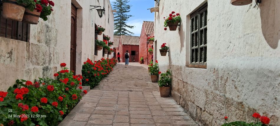
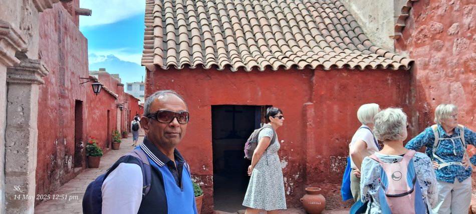
The Monastery of Santa Catalina. This 16th-century colonial convent is famous for its vibrant colored walls, narrow streets, and beautiful courtyards adorned with red geraniums.
At the Monastery of Santa Catalina,Founded in 1579, it served for centuries as a secluded nunnery for daughters of wealthy Spanish families and was not opened to the public until 1970
At the Monastery of Santa Catalina, The snow-capped peak visible in the background is the Chachani volcano.
The Puente Chilina (Chilina bridge) spanning 562 meters, it is the longest urban bridge in Peru. It stands approximately 40 to 50 meters above the valley floor.
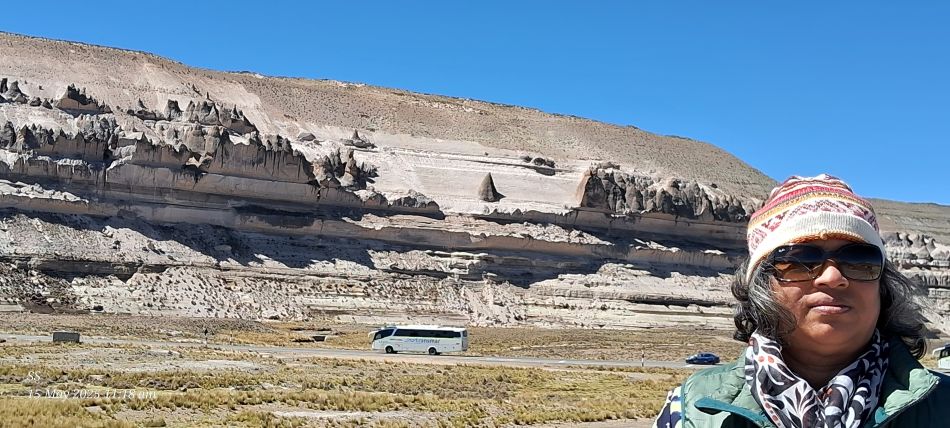
The Stone Forest in Patahuasi,located in the Salinas y Aguada Blanca National Reserve within the Arequipa region.The site is known for its dramatic, layered sandstone rock formations that have been sculpted by erosion.
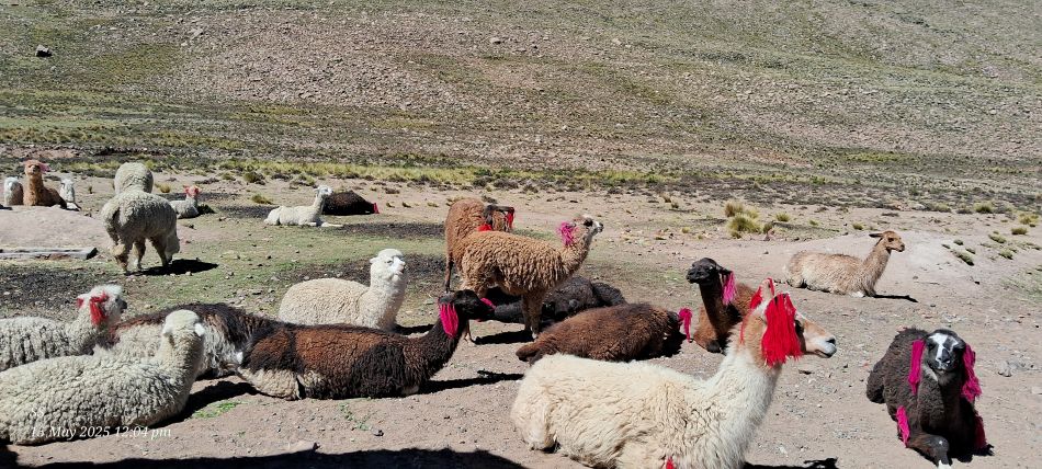
A herd of llamas and alpacas resting in a highland pasture.
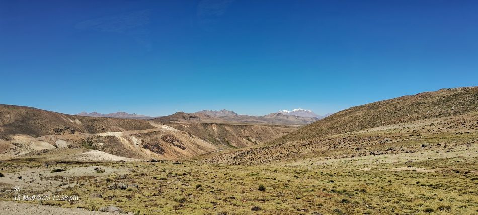
A scenic landscape within the Andean Highlands
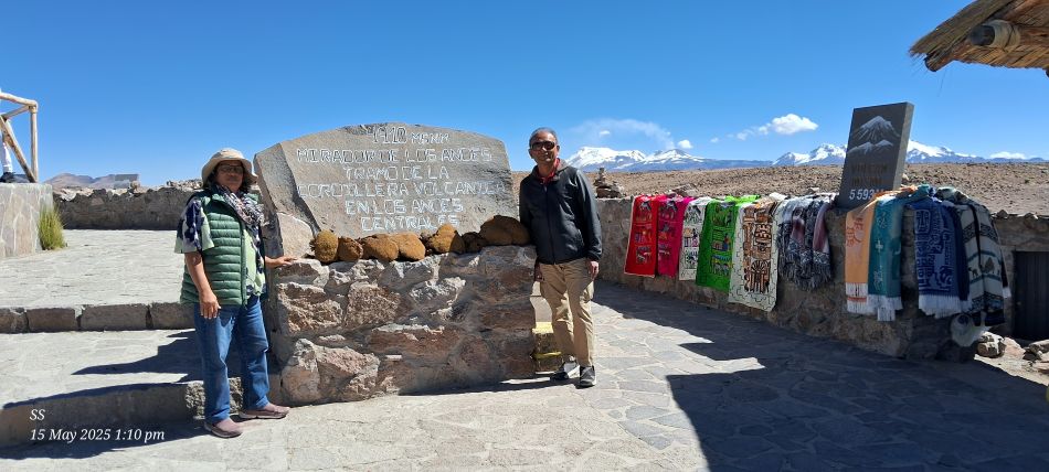
At the Mirador de los Andes (Andes Lookout), located at the Patapampa Pass in Peru. This viewpoint is situated at a high altitude of 4,910 meters (16,109 feet) above sea level
The Mirador de los Andes(Andes Lookout) also known as the Patapampa Pass, which is a high-altitude viewpoint in the Peruvian Andes. Located at an elevation of approximately 4,910 meters (over 16,000 feet) above sea level. The photo of this volcano, which stands at 6,025 meters.
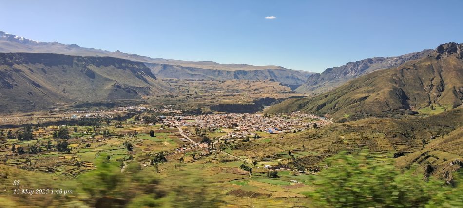
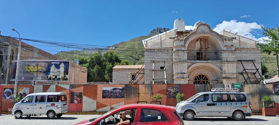
Panaromic view of the town of Chivay, located in the Colca Valley of the Arequipa region in Peru
At Colca Lodge Spa & Hot Springs, located in the Colca Canyon,region near Yanque, Peru.
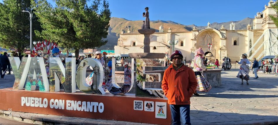
Photo stop at the Plaza de Armas in the town of Yanque, located in the Colca Canyon region of Arequipa, Peru.
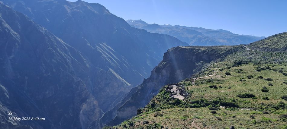
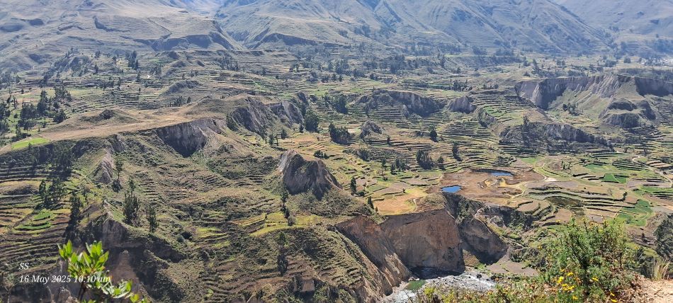
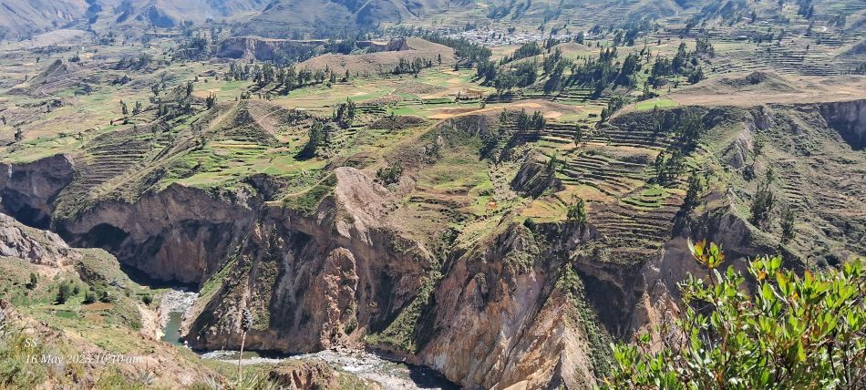
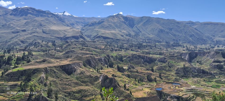
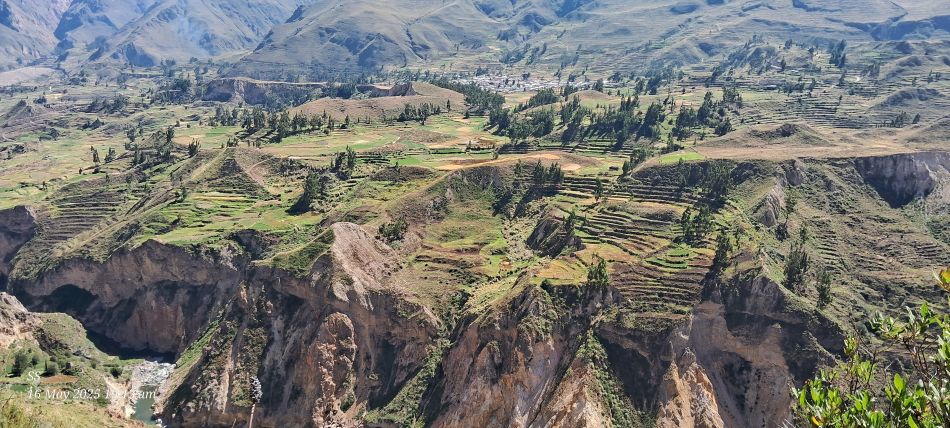
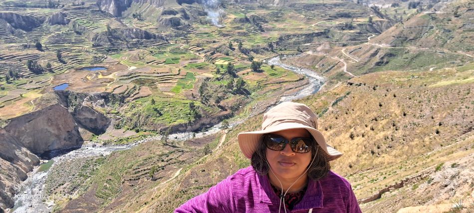
The Colca Canyon approximately 3,270 meters (10,730 ft), it is recognized as one of the deepest canyons in the world, roughly twice as deep as the Grand Canyon
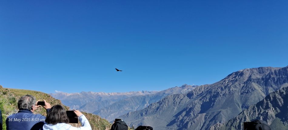
An Andean Condor (Vultur gryphus), one of the largest flying birds in the world
At Condor's Cross to see magnificent condors flying over the canyon
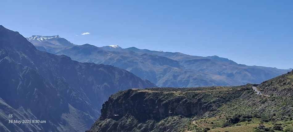
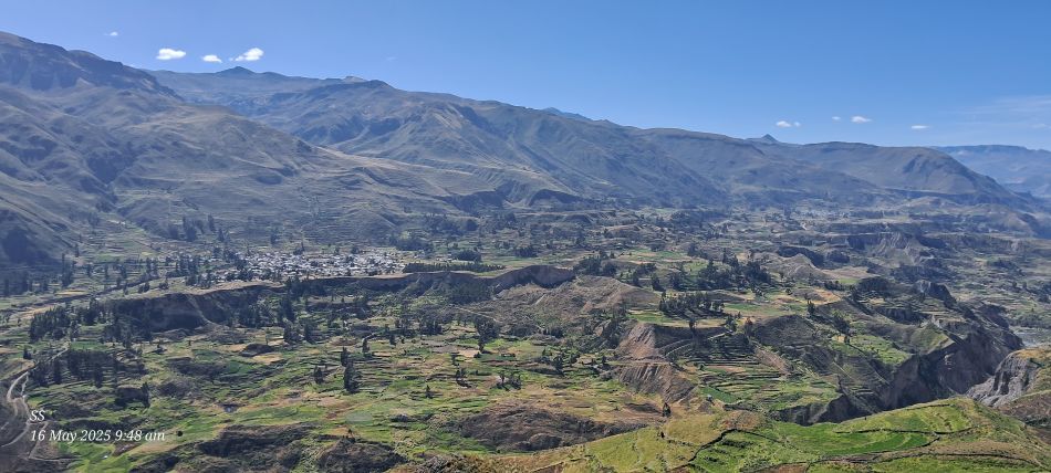
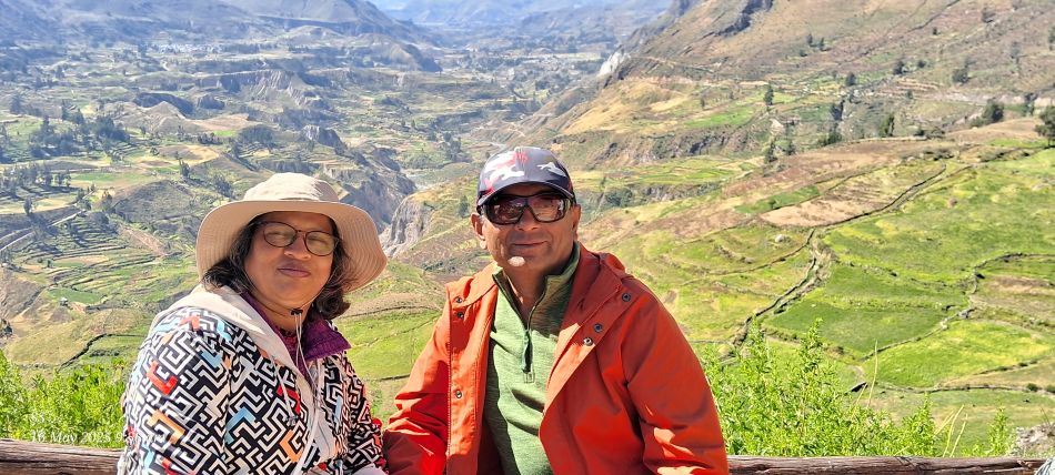
The stunning landscape of the Colca Canyon
The Colca canyon is famous for its colorful Andean valley and ancient agricultural terraces that date back to pre -Inca times.
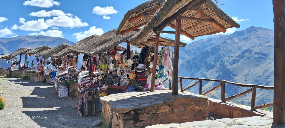
At the Colca Canyon, the traditional artisanal souvenir stalls are located at a scenic viewpoint.
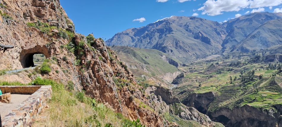
Scenic view of the Colca Canyon, A road tunnel on a mountain edge.
At the Colca Canyon, the pre Inca agricultural terraces that still carve into the valley's slopes today
The canyon was carved out by the Colca River, which winds through the steep, dramatic cliffs , The area is famous for its colorful Andean valley featuring pre-Inca agricultural terraces that are still used today by local inhabitants.
The panaromic view of Colca Canyon
The panaromic view of Colca Canyon
The Colca river flows through the base of the canyon, carving out the dramatic Andean scenery.
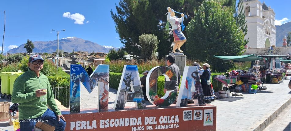
The Plaza de Armas of Maca,the town of Maca, famed for its pre-Columbian textiles, this traditional town located in the Colca Canyon region of Arequipa.
The Iglesia Santa Ana de Maca, a historic colonial church located in the village of Maca within the Colca Canyon region of Arequipa.
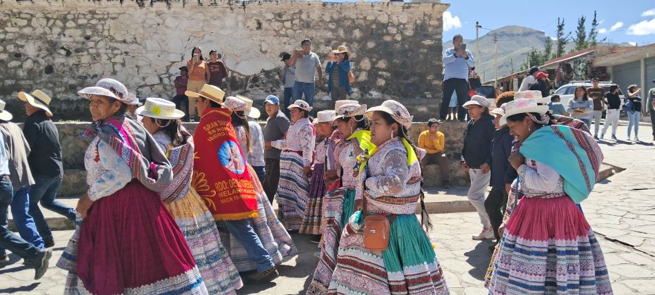
The women are wearing layered, colorful embroidered skirts and shoulder cloths known as llicllas. These garments are a hallmark of the Colca Valley's rich cultural heritage.
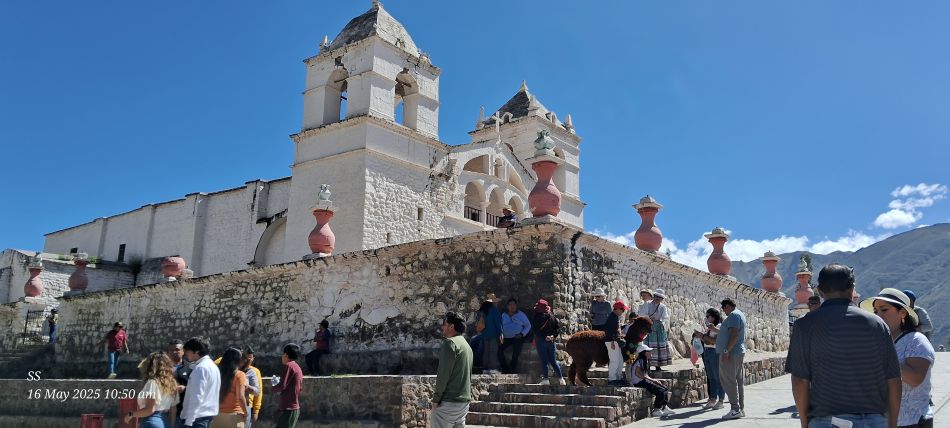
The Plaza de Armas de Chivay in Chivay, Chivay serves as a primary starting point for tours into the Colca Canyon.
The Templo Nuestra Senora de la Asuncion (Church of Our Lady of the Assumption), a prominent historical landmark located in Chivay.
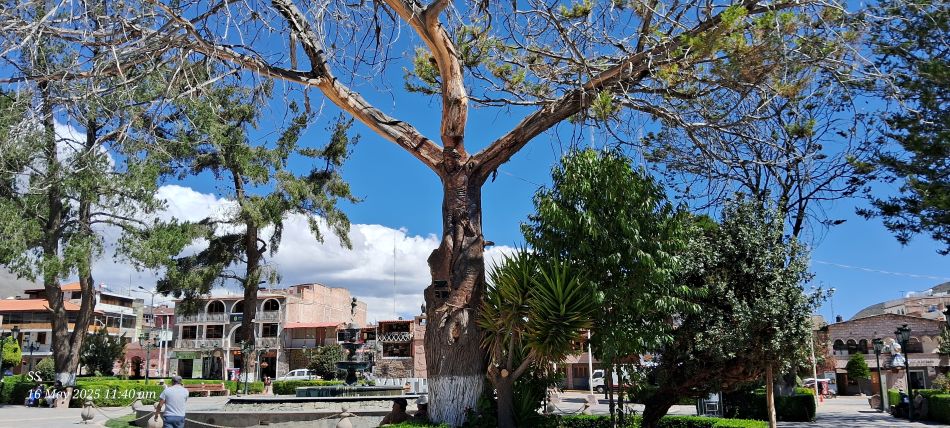
A massive, ancient eucalyptus tree.
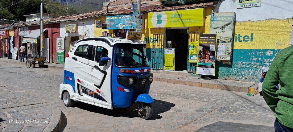
Tuk-Tuk, The blue and white three-wheeled vehicle is a common form of local transportation throughout many Peruvian towns.
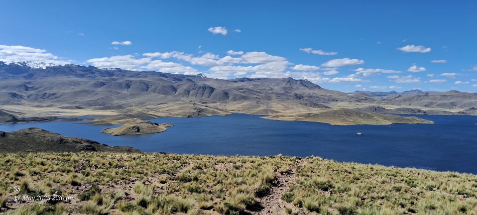
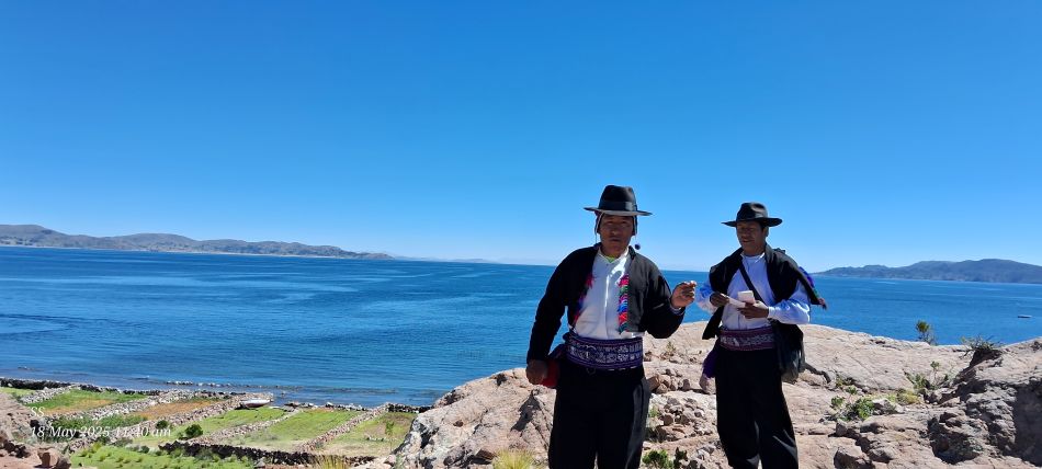
This beautiful alpine lake is Laguna Lagunillas, located in the Puno Region of the Peruvian Andes.
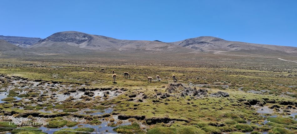
Vicunas are grazing in the marshy wetlands in the national reserve park, These wild camelids are native to the high Andes and are known for producing some of the finest and most expensive wool in the world.
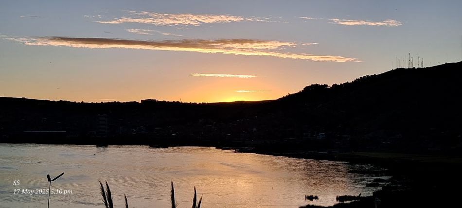
Sunset at lake titicaca
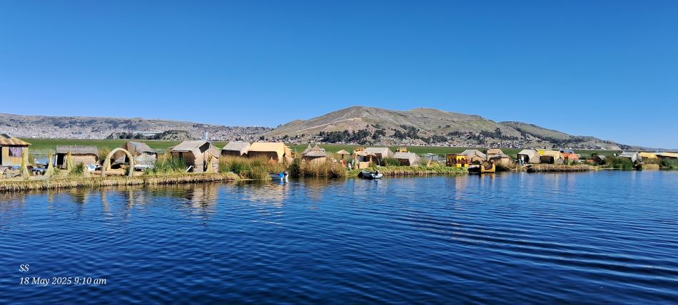
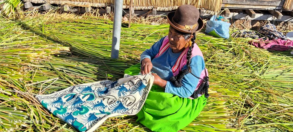
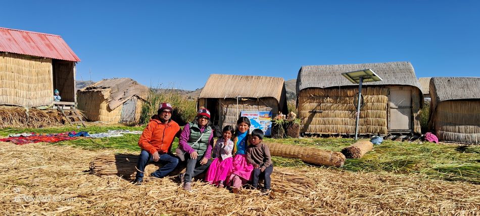
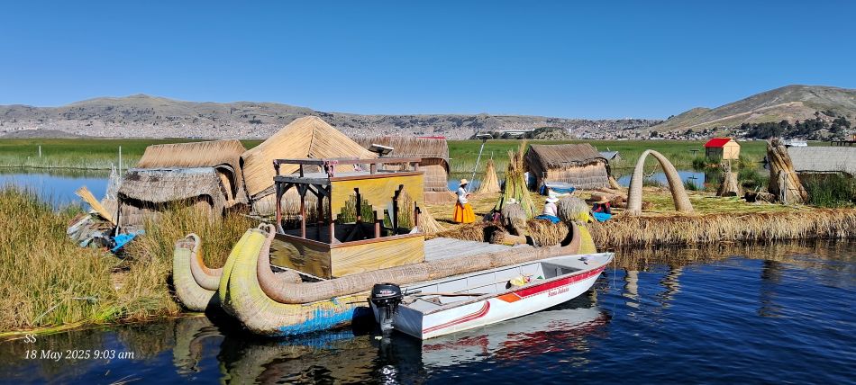
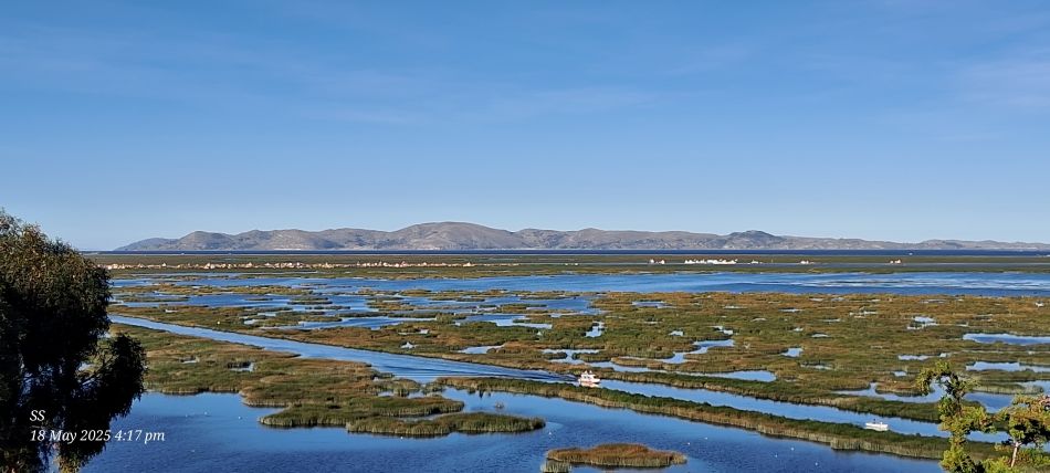
Tour of the floating Uros reed islands in lake Titicaca
for hundreads of years the livlihhod of this water tribe has been based on the benefits of the totora reed, which grows densely in the shallower areas of the lake
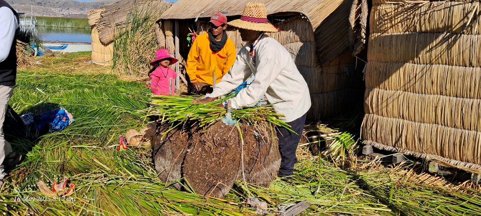
Indigenous Uros people
Photo stop with the Uros people
The Uros people live by fishing and raising domestic fowl and they travel between their islands in tiny reed boats
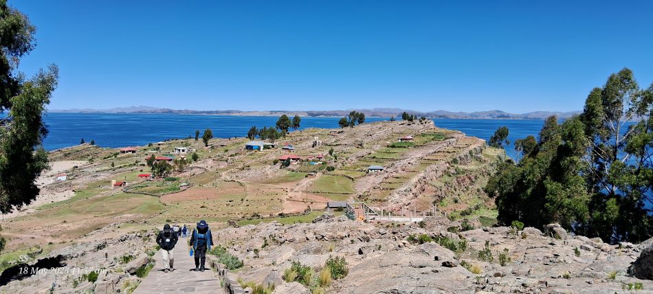
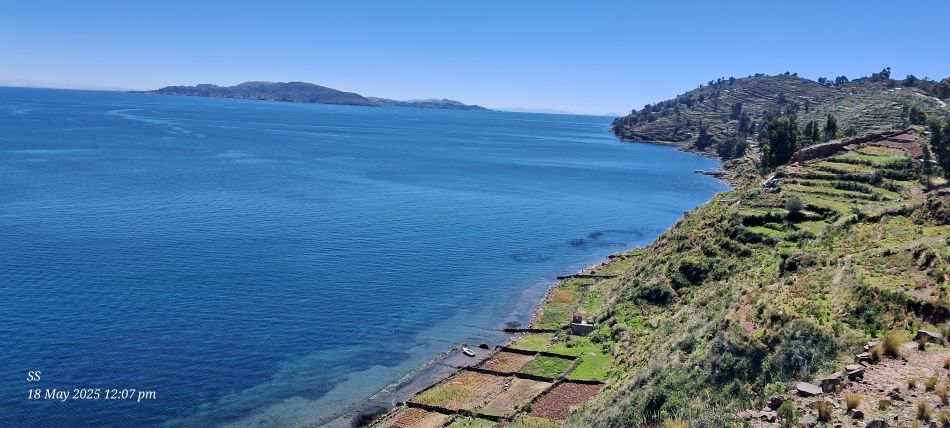
Tour of the Taquile Islands
The taquile island
View across to Bolivia
Lake titicaca
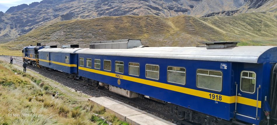
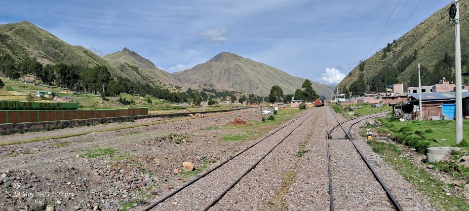
Peru rail Titicaca train, Titicaca train to Cuzco
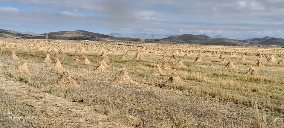
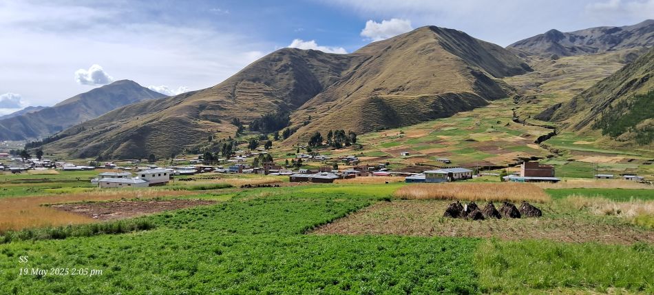
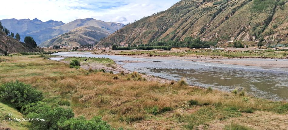
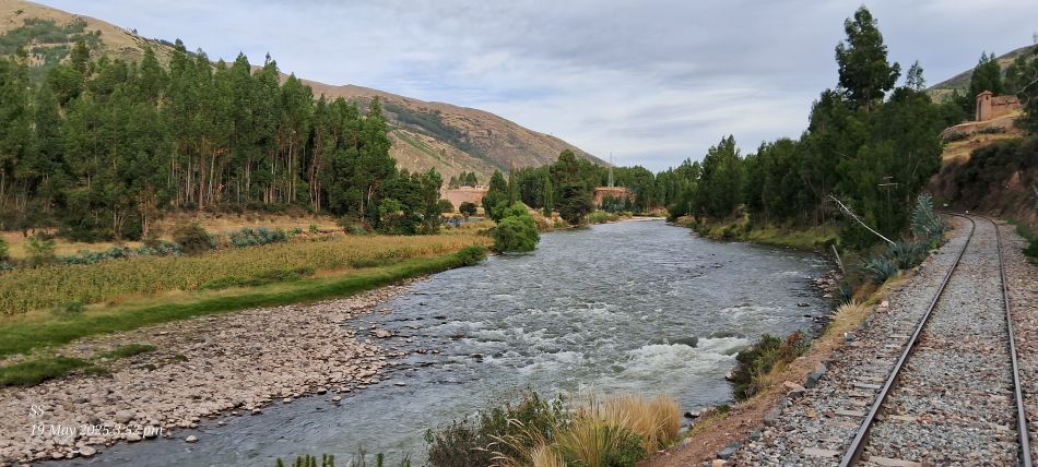
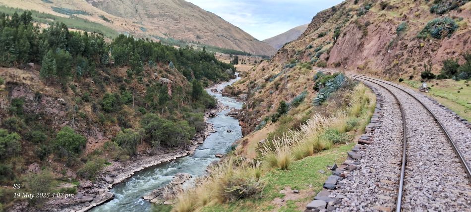
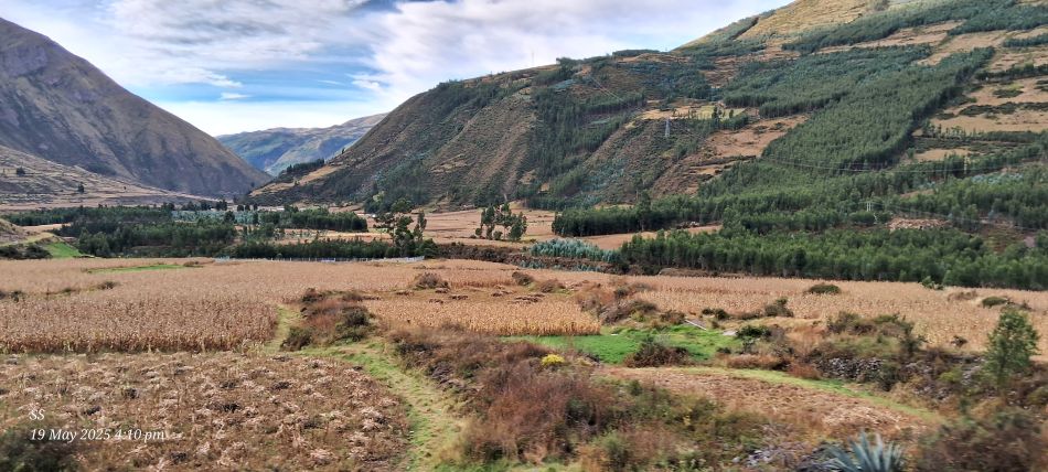
The scenic journey, passing through rolling Andean plains.
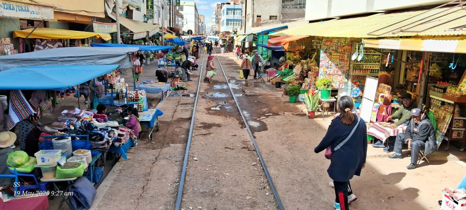
A busy street market in Juliaca, Peru, where stalls are set up directly alongside active railway tracks. This location is a major trade center in the Puno.
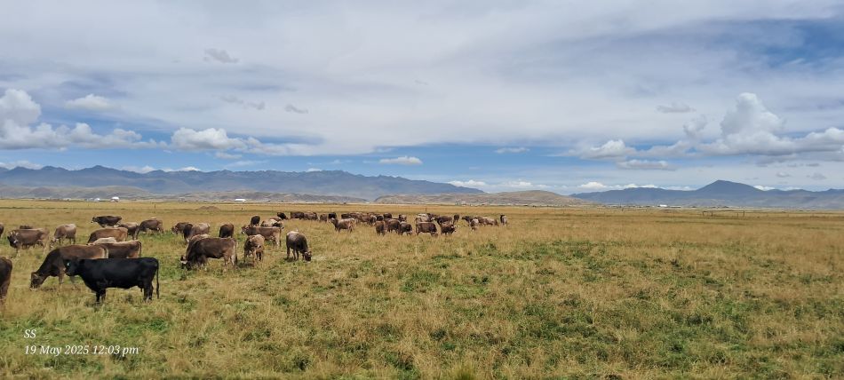
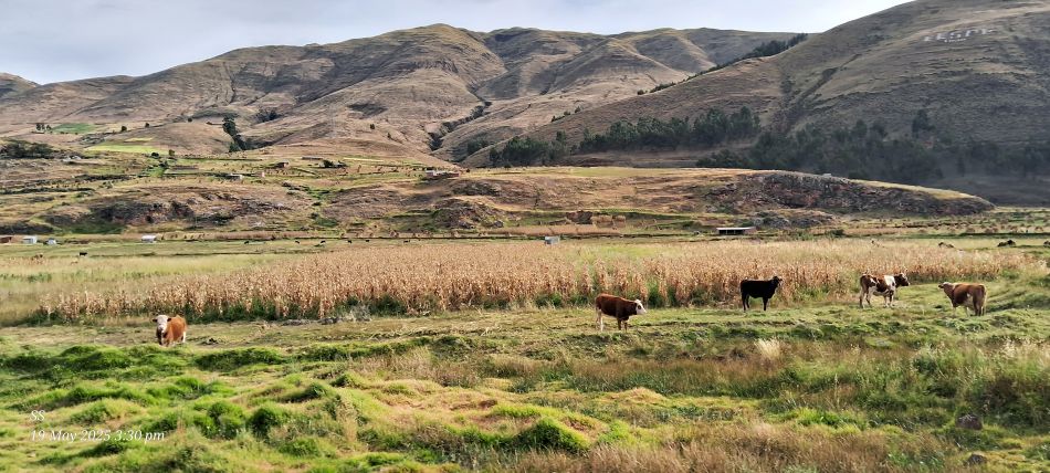
The scenic journey, a herd of cattle grazing in a vast, open landscape.
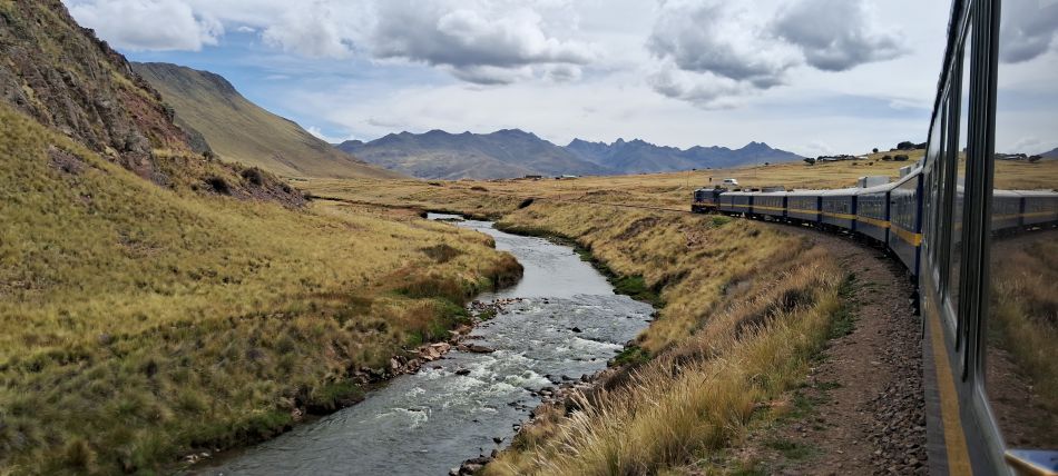
The PeruRail Titicaca Train winding through the high-altitude Altiplano landscape of the Peruvian Andes. This scenic 241-mile journey connects the cities of Cusco and Puno, traveling through dramatic mountain passes and golden rural fields.
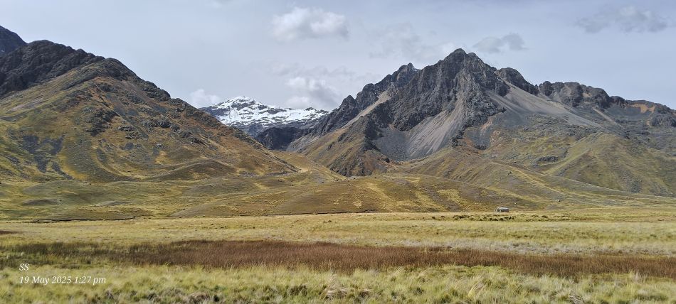
The La Raya mountain range in the Peruvian Andes, This pass serves as the natural boundary between the Cusco and Puno regions of Peru.
The La Raya Pass (Abra La Raya), the highest point on the scenic road and rail route between Cusco and Puno in the Peruvian Andes.
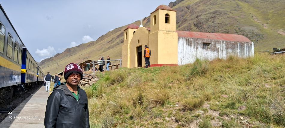
At the La Raya station.
At La Raya Pass, the small, yellow chapel in the background is the La Raya church, a notable landmark at this high-altitude station
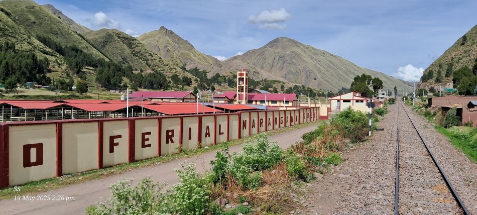
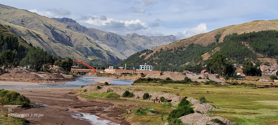
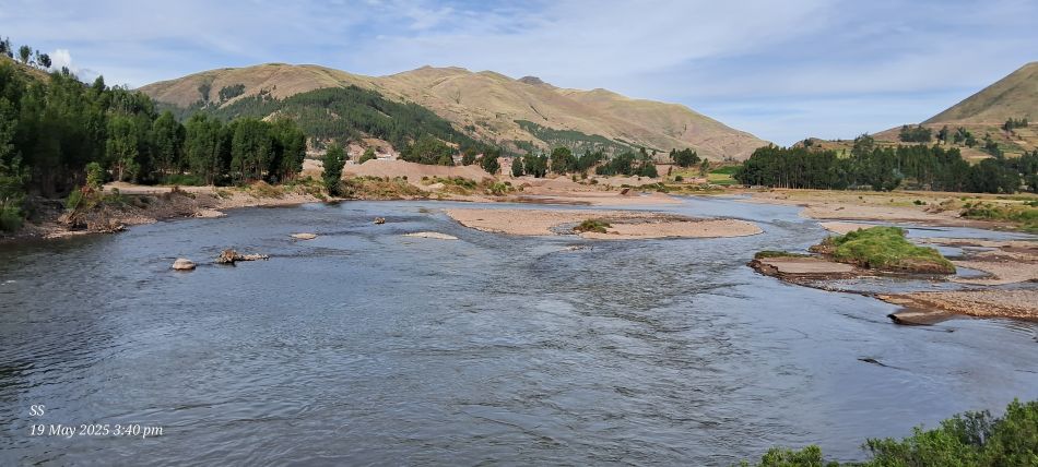
The scenic journey
The scenic journey
The scenic journey
The scenic journey
The scenic journey
The scenic journey
The scenic journey
The scenic journey
The scenic journey
The Sacred Valley of the Incas also known as the Urubamba Valley, located in the Cusco region of the Peruvian Andes.
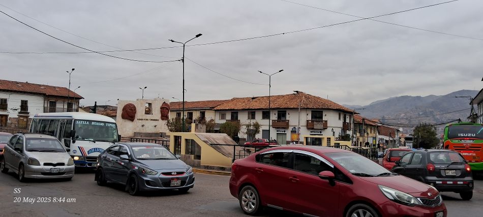
Plaza Limacpampa (also known as Limaqpampa Grande), a public square located in the city of Cusco.
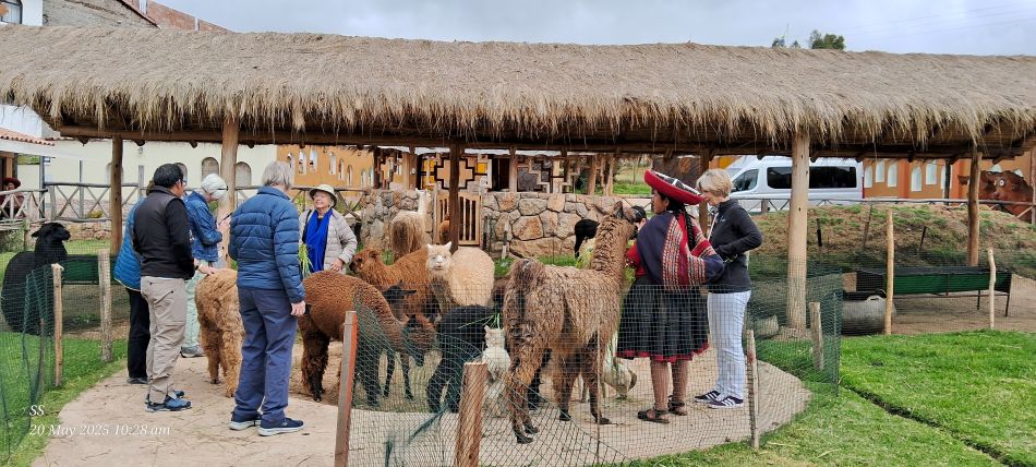
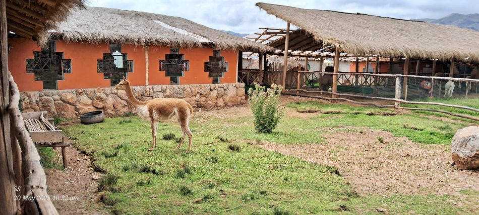
A camelid farm tour in the Cusco, primarily alpacas and llamas
Farm tours in the Sacred Valley.
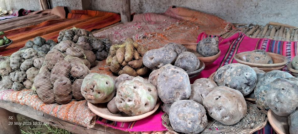
A diverse collection of native Peruvian potatoes
High-quality wool is collected from llamas, alpacas, and other native animals.
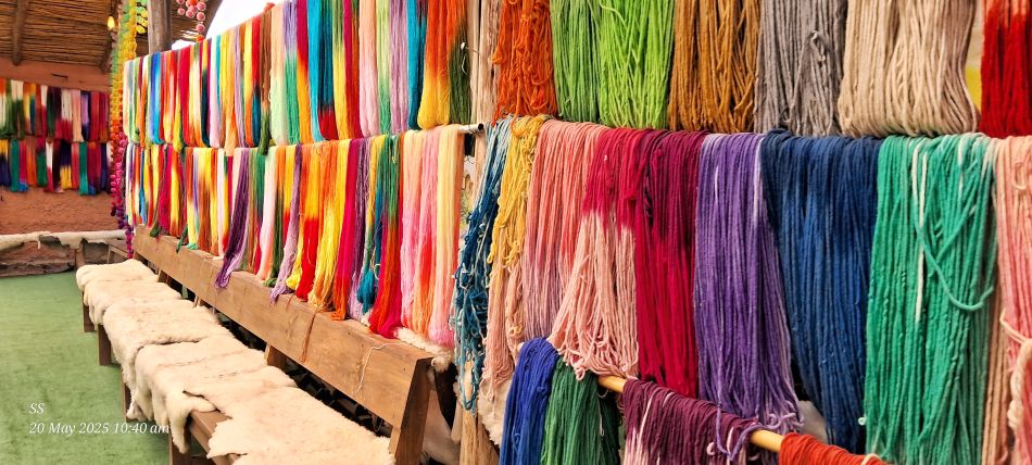
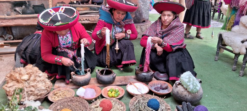
A traditional textile center,Awana Kancha in Cusco. The artisans demonstrating the ancient process of treating and dyeing wool from South American camelids like llamas, alpacas, and vicunas.
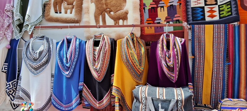
Vibrant collection of traditional Peruvian handicrafts, including alpaca wool ponchos, textile wall hangings, and alpaca fur rugs
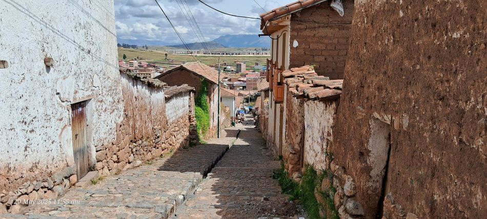
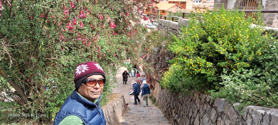
tSeep alley in the town of Chinchero
A traditional street in Chinchero
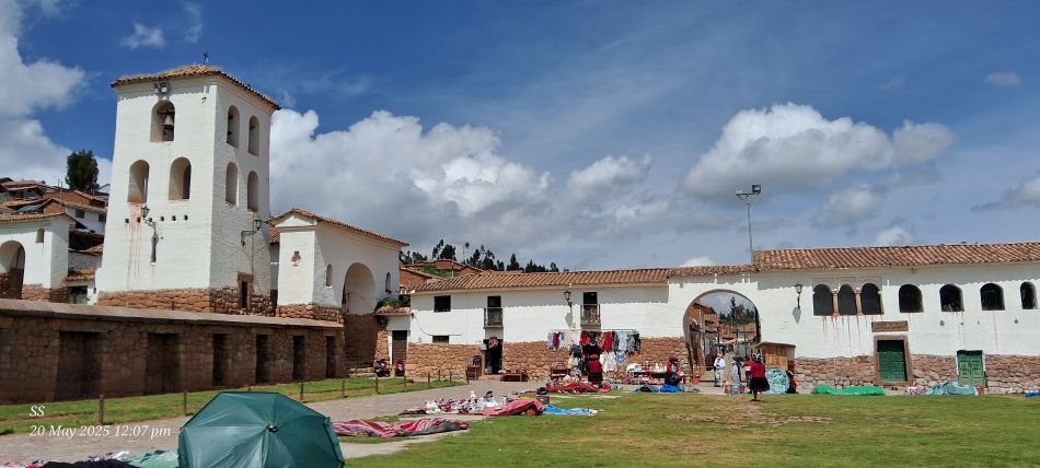
The Colonial Church of Our Lady of the Nativity, a historic site located in the village of Chinchero
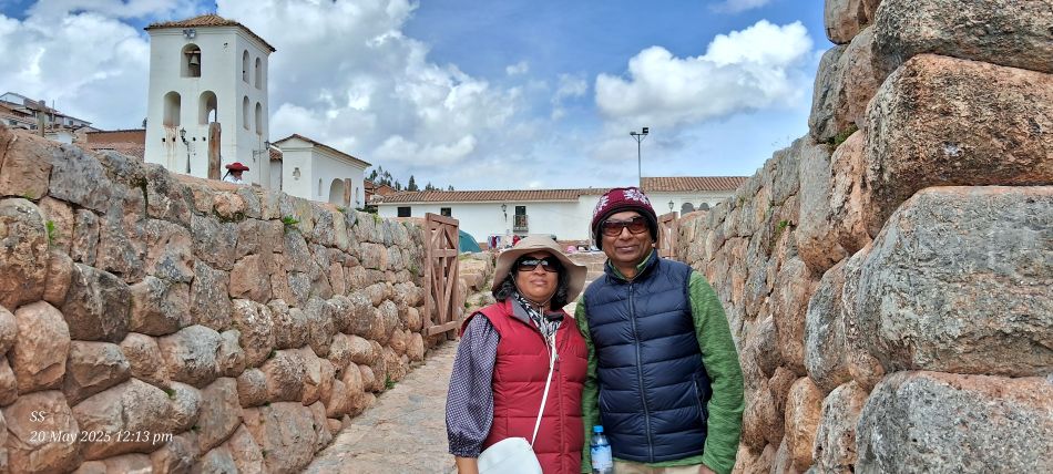
At the Chinchero Archaeological Site in the Sacred Valley of Peru.
The Chinchero Archaeological Complex, located in the town of Chinchero within the Sacred Valley of the Incas.
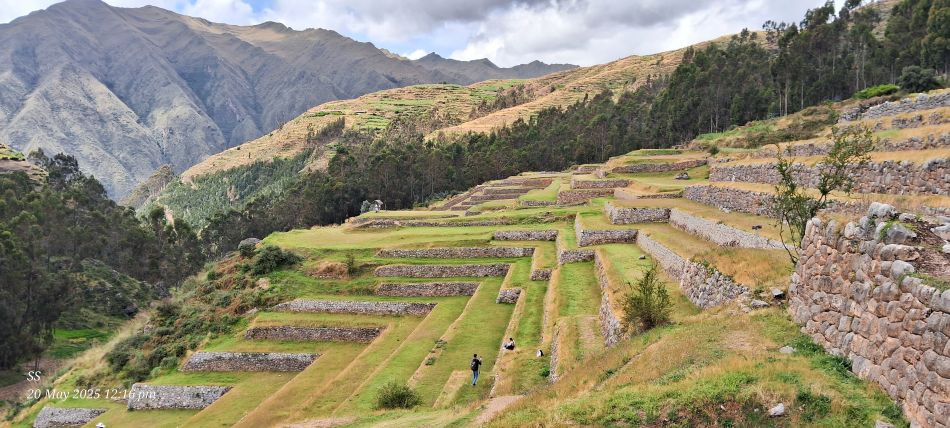
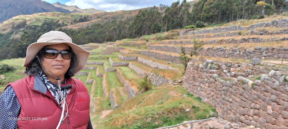
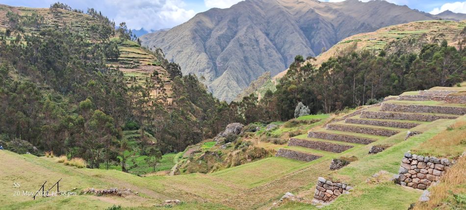
The Chinchero Archaeological Park in Peru's Sacred Valley. This site is famous for its extensive Incan agricultural terraces, which remain remarkably well-preserved.
The Chinchero Archaeological Park in Peru's Sacred Valley.
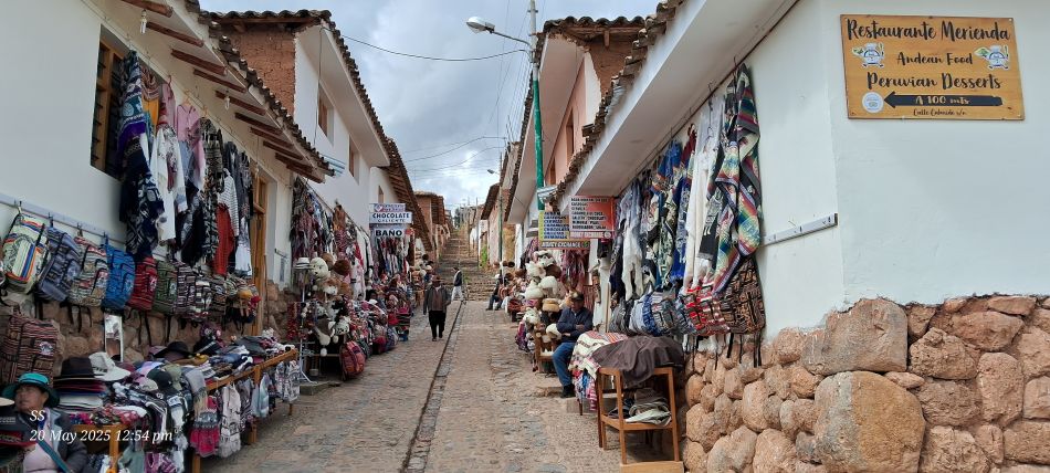
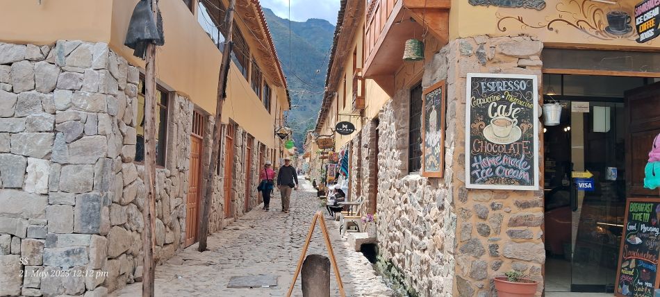
A narrow, cobblestone market street in the historic village of Chinchero, located in the Sacred Valley. The street is lined with vendors selling handmade Andean goods, including colorful ponchos, hats, and backpacks.
on a stone path in the Inca village of Ollantaytambo.
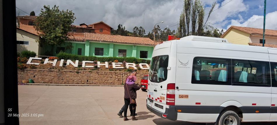
The town of Chinchero
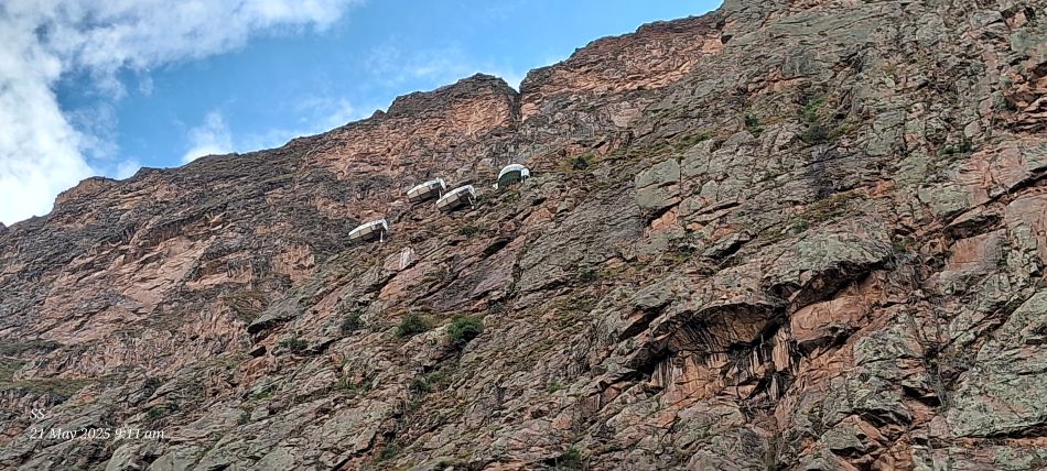
Sky lodge, a unique hanging hotel located in the Sacred Valley
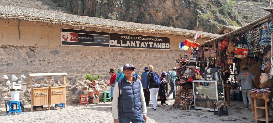
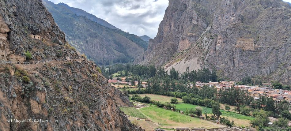
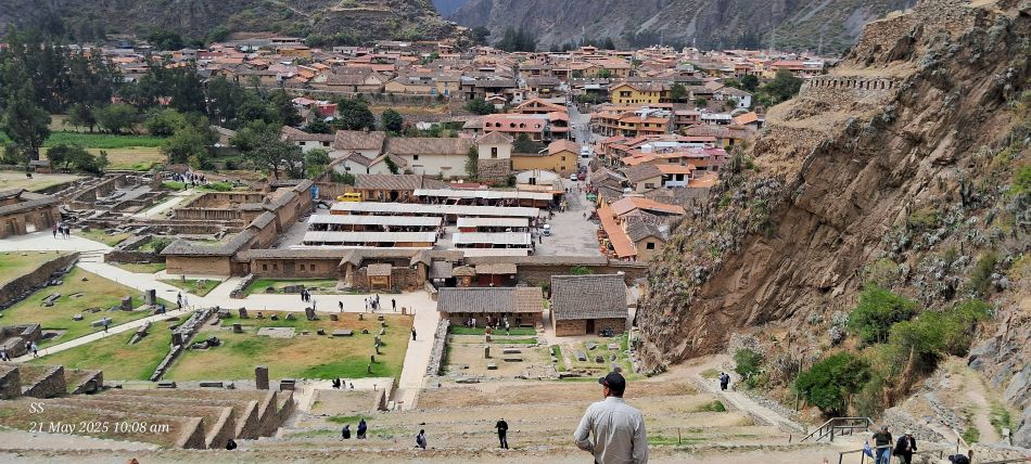
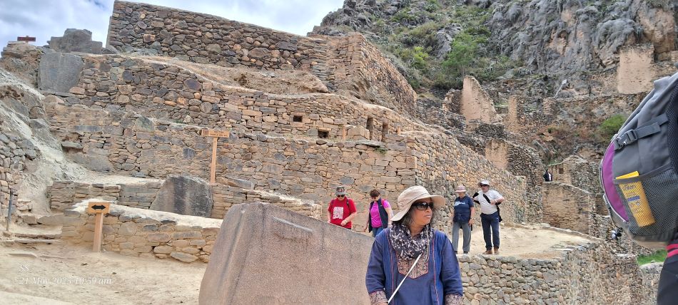
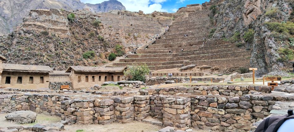
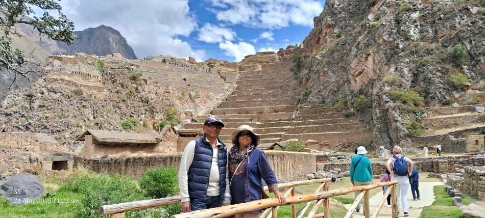
The entrance to the Ollantaytambo National Archaeological Park. The Ollantaytambo fortress
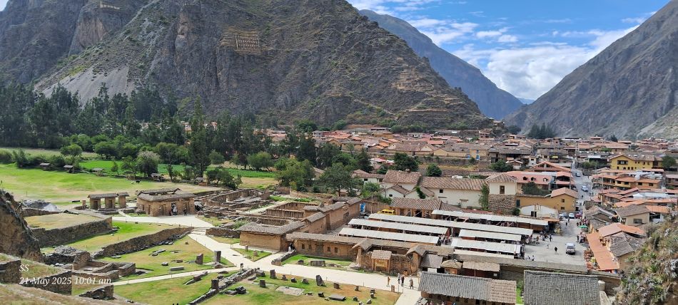
The Ollantaytambo Archaeological Site and the adjacent "Living Inca Town",because many of its current residents still live in original Inca-built homes and use the same narrow cobblestone streets and irrigation canals.
The Pinkuylluna Archaeological Site, an ancient Incan storage facility overlooking the town of Ollantaytambo. The stone structures visible on the steep cliffs across the valley are the Pinkuylluna granaries. These were built high on the mountainside to take advantage of lower temperatures and better wind flow, which helped preserve stored grain.
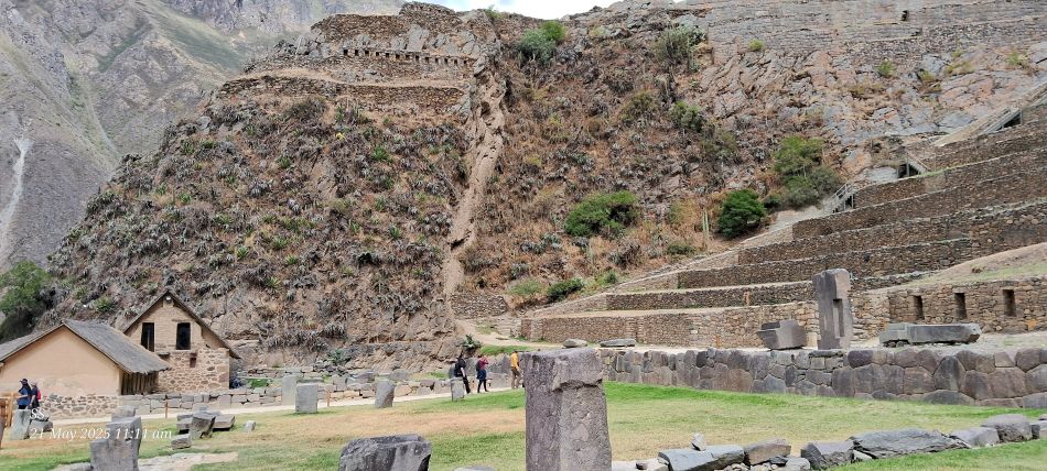
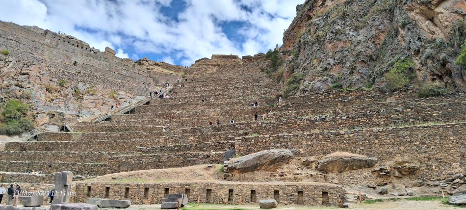
The Ollantaytambo Archaeological Park
The Ollantaytambo archaeological park, The view from the ruins overlooking the valley shows extensive agricultural terraces, ceremonial centers, and defensive structures.
The Ollantaytambo Archaeological Park
The Ollantaytambo Archaeological Park
The Ollantaytambo Archaeological Park
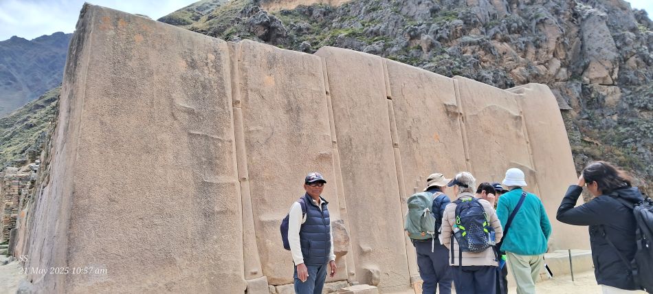
The Wall of the Six Monoliths, the centerpiece of the Temple of the Sun at the Ollantaytambo Archaeological Park
The Ollantaytambo Archaeological Park, a monumental Inca site.
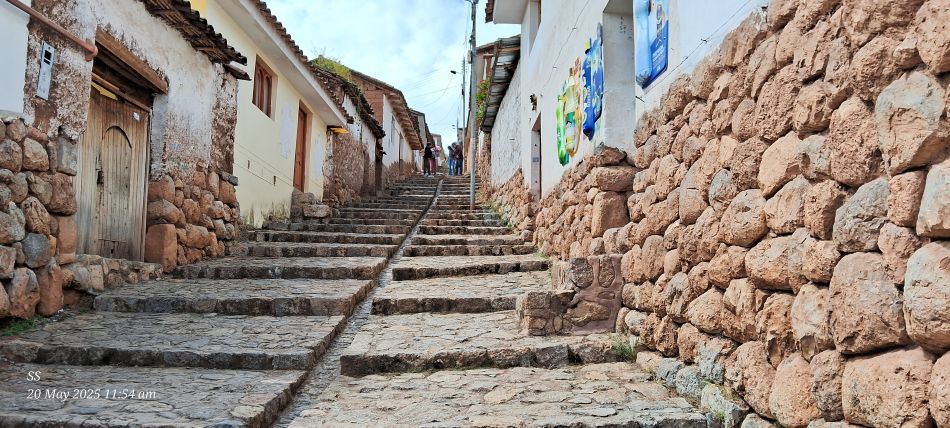
A narrow, cobblestone street in the historic town of Ollantaytambo
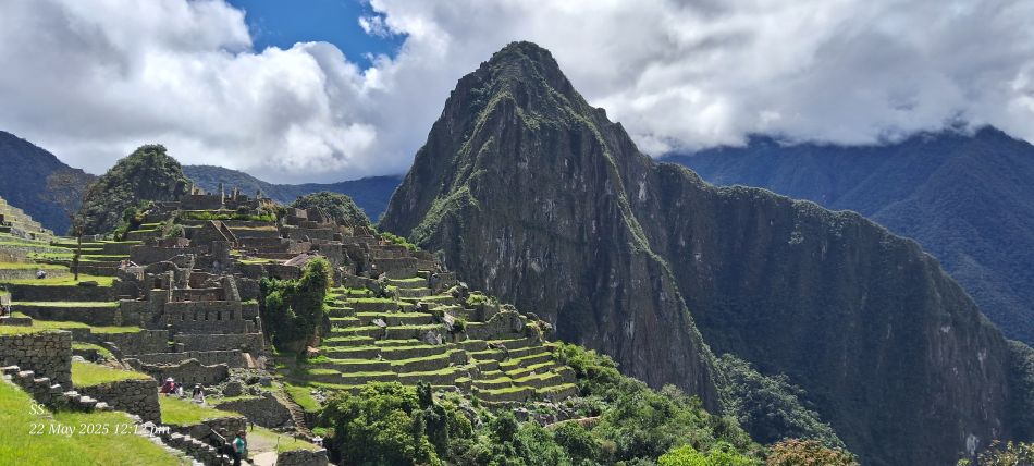
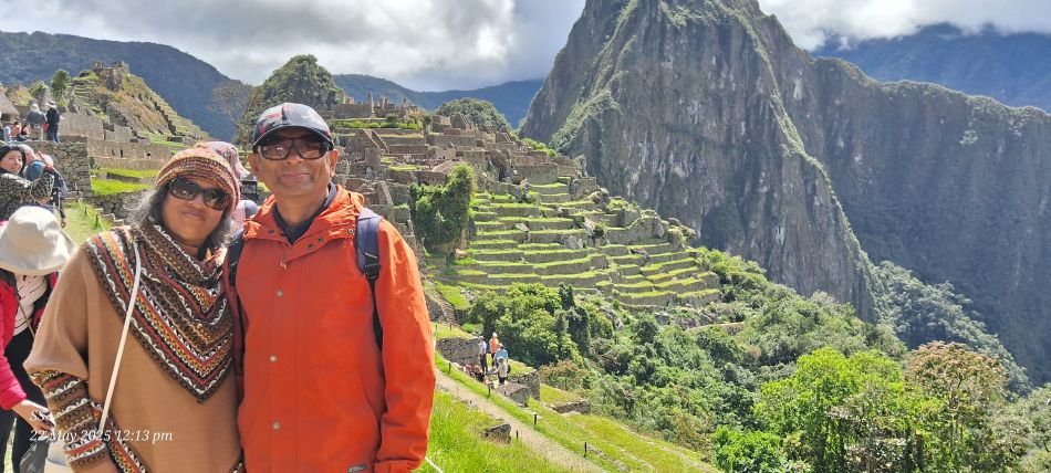
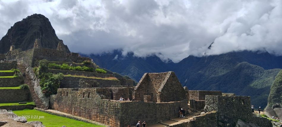
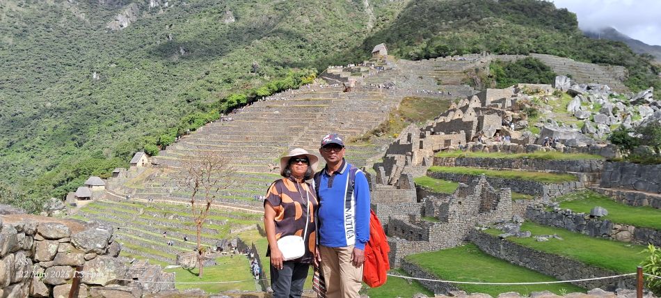
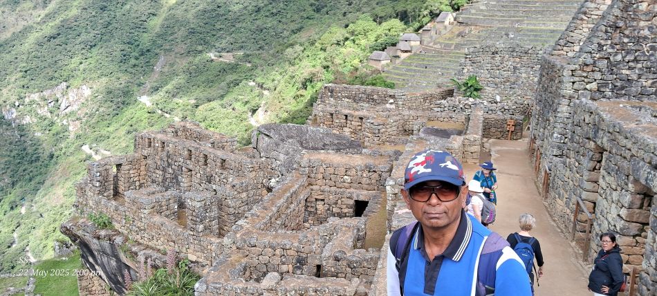
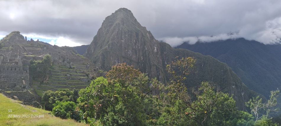
The iconic 15th-century Inca citadel of Machu Picchu.The prominent mountain towering behind the ruins is Huayna Picchu, which visitors can hike for a panoramic bird's-eye view of the entire site.
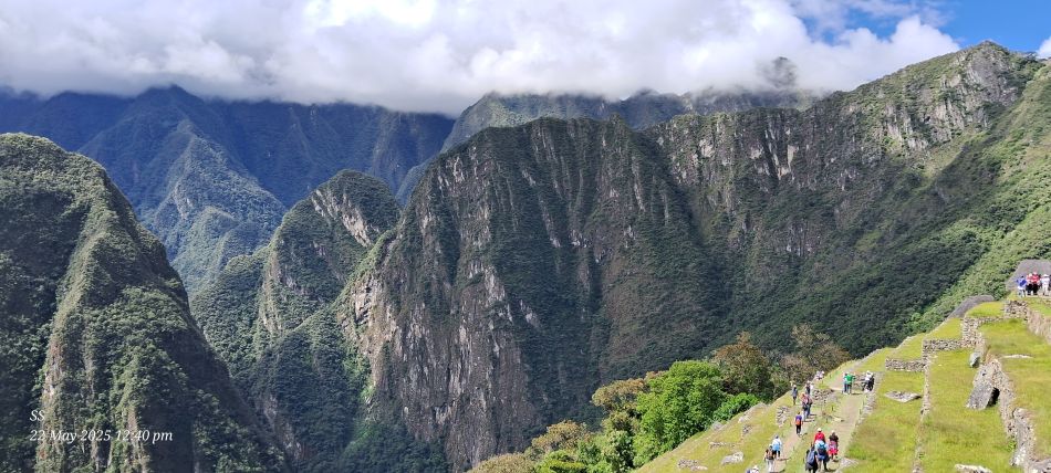
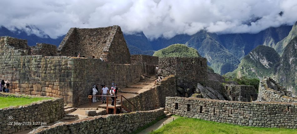
National Archaeological Park Of Machu Picchu,Set on a mountain ridge 2,430 meters (7,970 ft) above sea level, it is considered one of the Seven Wonders of the World.
National Archaeological Park Of Machu Picchu
National Archaeological Park Of Machu Picchu, It is recognized globally as a UNESCO World Heritage Site
National Archaeological Park Of Machu Picchu
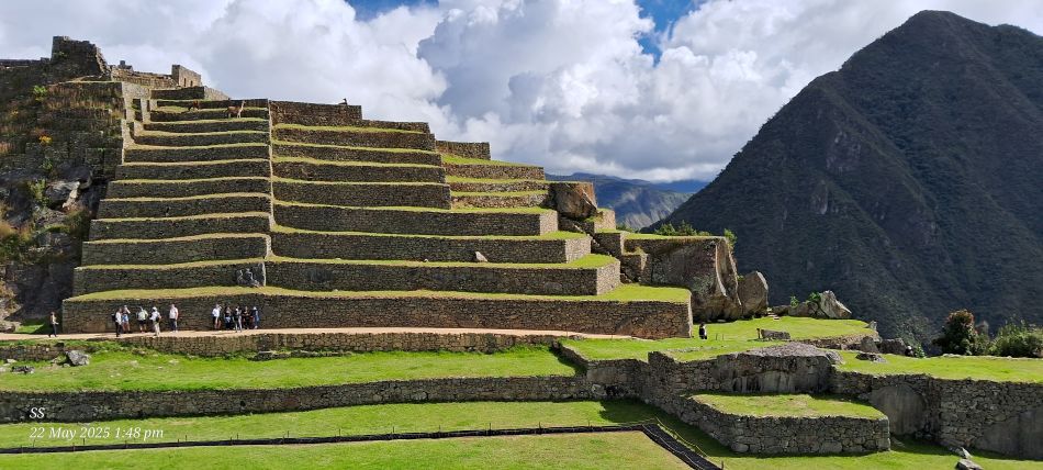
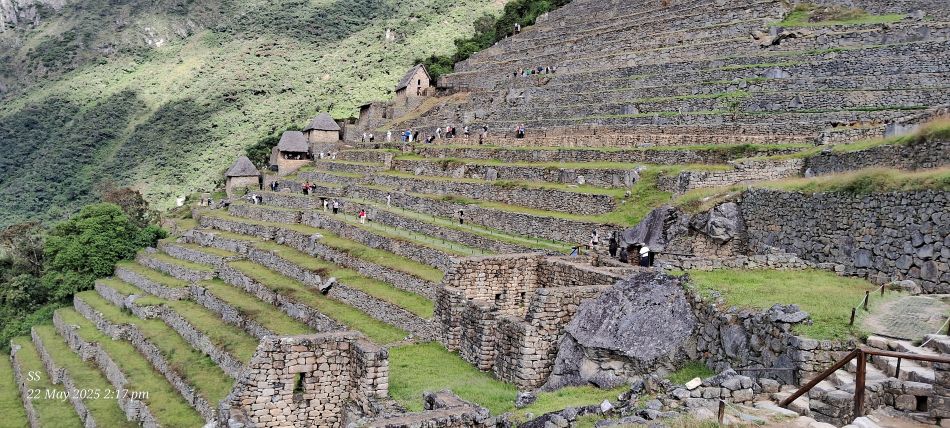
National Archaeological Park Of Machu Picchu,The site is renowned for its incredible Inca engineering, featuring sophisticated dry-stone walls and extensive agricultural terraces (andenes) built into the steep mountain ridges.
The impressive agricultural terraces, known as andenes, at the Historic Sanctuary of Machu Picchu. The steep, green-topped mountain rising in the background to the right is the iconic Huayna Picchu (or Wayna Picchu), which offers panoramic views of the entire citadel to those who hike its narrow "Stairs of Death".
The famous Inca citadel of Machu Picchu, Often referred to as the "lost city of the Incas", This UNESCO World Heritage Site is situated high in the Andes Mountains.
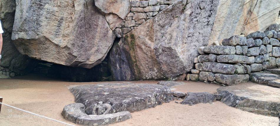
The Temple of the Condor at the Inca citadel of Machu Picchu.Two massive natural rocks on the sides are shaped to look like the outspread wings of a condor.
The agricultural terraces at Machu Picchu. Those steps were a brilliant feat of Incan engineering designed to create more farmland, prevent soil erosion, and manage water drainage in the steep mountain environment.
The prominent peak rising in the background is Huayna Picchu (or Wayna Picchu), which offers spectacular, near-vertical views over the ruins.
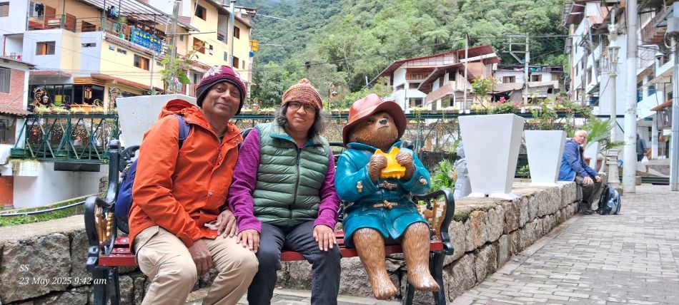
A statue of Paddington Bear located in Machu Picchu Pueblo, near Machu Picchu train station.
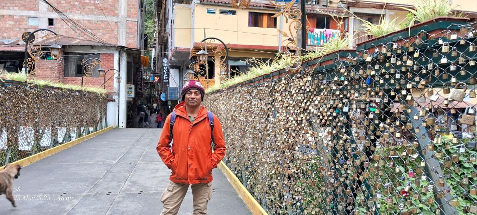
On the "Puente Ruinas" bridge (often referred to as the Love Lock Bridge) in Aguas Calientes. This pedestrian bridge is a notable landmark in Machu Picchu Pueblo, the town at the base of the famous Inca ruins. It crosses the Urubamba River and has become a popular spot for couples to attach padlocks to the chain-link fence as a symbol of their lasting commitment.
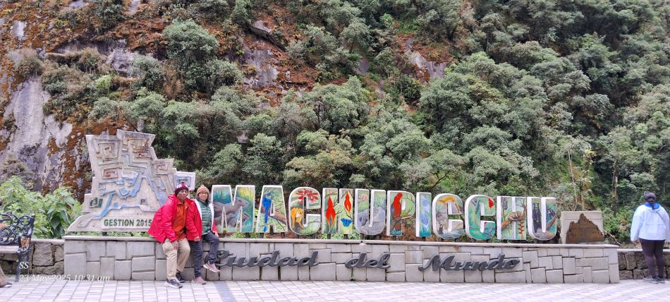
The famous colorful Machu Picchu "Ciudad del Mundo" (City of the World) welcome sign located in the town of Aguas Calientes
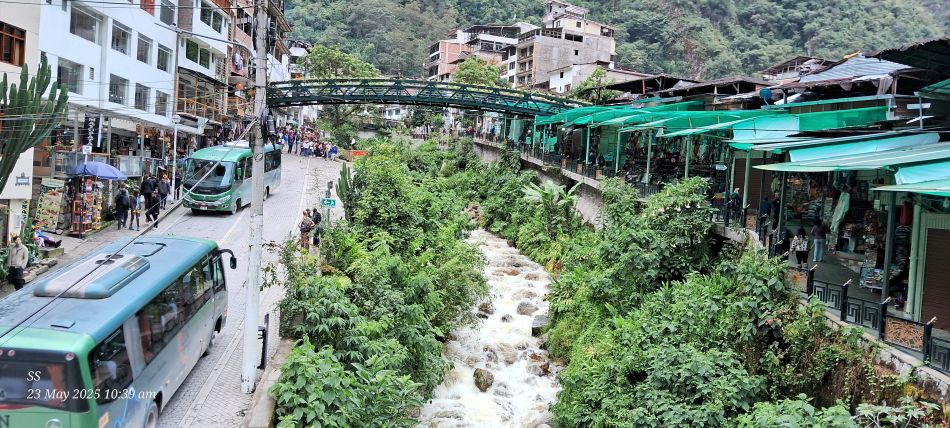
The town of Aguas Calientes, also known as Machu Picchu Pueblo. This town is the primary gateway for visitors traveling to the ancient Incan citadel of Machu Picchu, which is located on the mountain above.
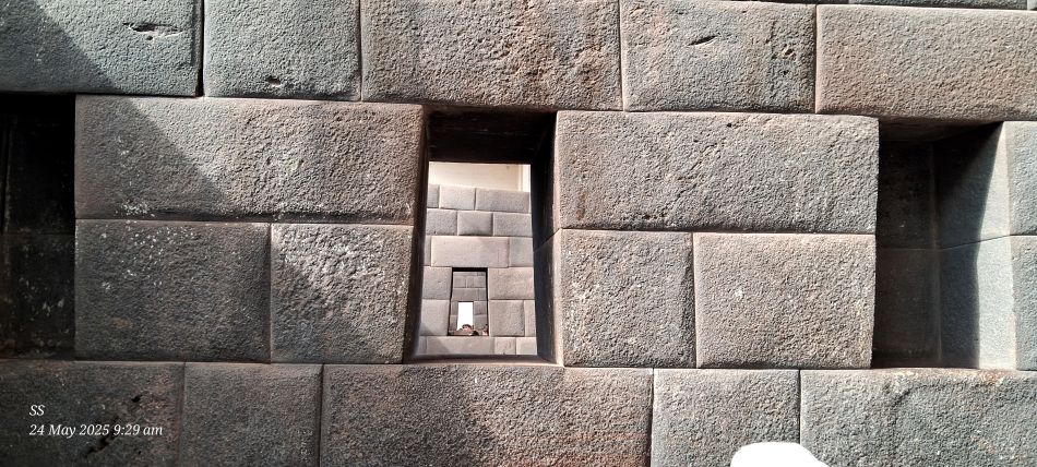
Cuzco- Qorikancha sun temple, the remarkable precision of Inca stonework at the Coricancha (also spelled Qorikancha), the most important temple in the Inca Empire, located in Cusco. Three perfectly aligned trapezoidal windows within the Temple of the Rainbow
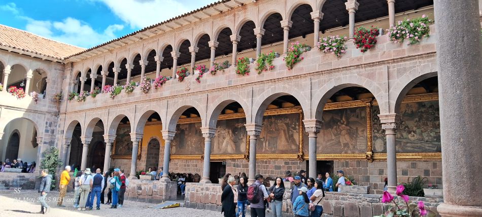
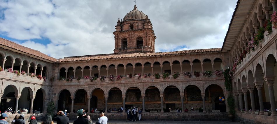
The central courtyard of the Qorikancha (Coricancha) Sun Temple and the Convent of Santo Domingo in Cusco.
The courtyard of the Church and Convent of Santo Domingo in Cusco, Peru.
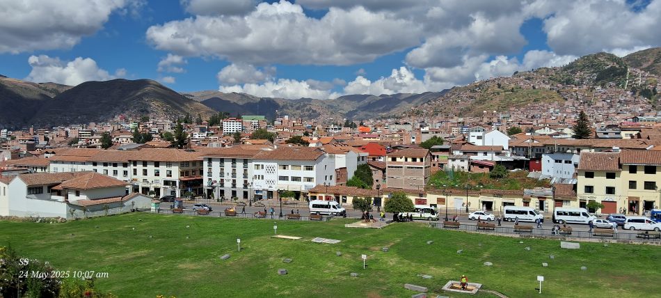
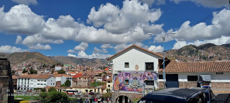
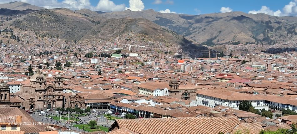
A panoramic view of Cusco.
The sprawling cityscape of Cusco nestled against the Andean mountains
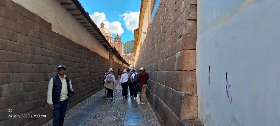
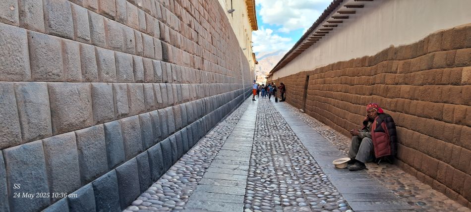
The "Street of the Sun" in the historic center of Cusco. The street is famous for its exceptionally well-preserved Inca walls. These walls are characterized by large, precision-cut stones that fit together perfectly without the use of mortar.
Calle Loreto is also known as "Alley of the Sun" Since 1983, this area has been recognized as a UNESCO World Heritage Site as part of the city's historic core.
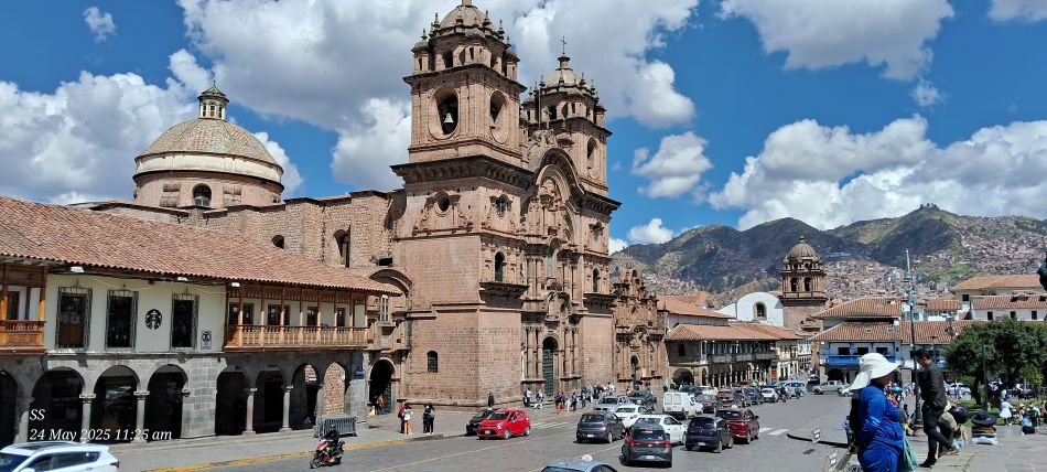
The Iglesia de la Compania de Jesus (Church of the Society of Jesus), a historic Jesuit church located in the Plaza de Armas in Cusco
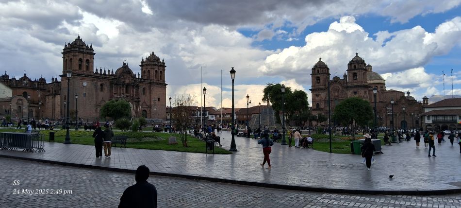
The Plaza de Armas, the city's central square, and the prominent Cusco Cathedral with its two bell towers. On the hill in the background
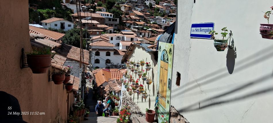
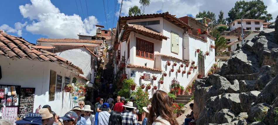
Calle Siete Borreguitos (Street of Seven Little Lambs), one of the most picturesque and photographed streets in the traditional San Blas neighborhood of Cusco
Street of the Seven Little Lambs, The street is famous for its white colonial-style houses adorned with numerous colorful flower pots hanging from the walls.
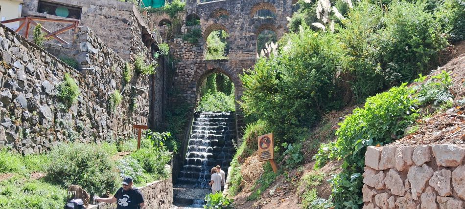
The Sapantiana Colonial Aqueduct, It is a three-level stone arch structure.
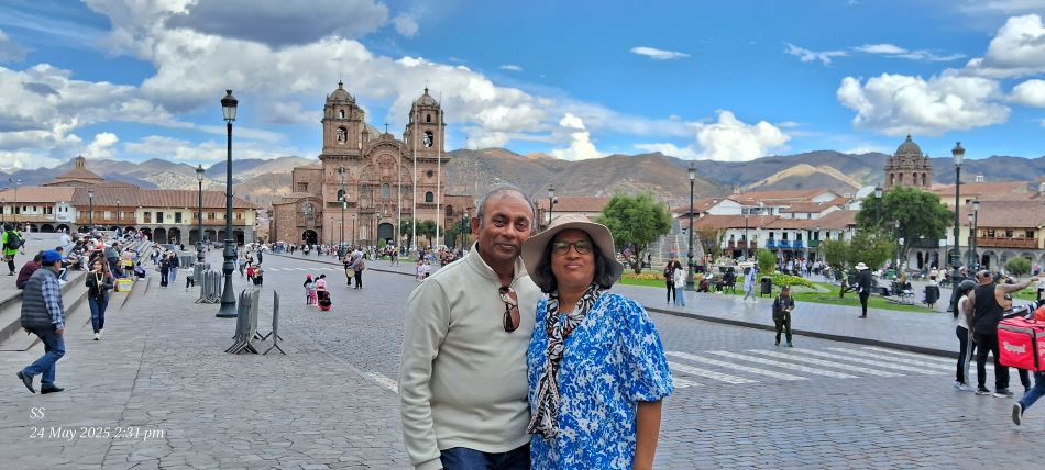
The Plaza de Armas in Cusco, a historic city center that once served as the capital of the Inca Empire.
The Plaza de Armas, the main central square of Cusco. The Cusco Cathedral on the left side and on the right side Church of the Society of Jesus. The square is famous for its hybrid architecture, featuring colonial buildings constructed directly atop ancient Inca foundations.
|